You are here > Home >
Georgia >
McQueen's Island Trail
Updated: October 2023
McQueen's Island Trail... Georgia
Scenic Biking near Savannah
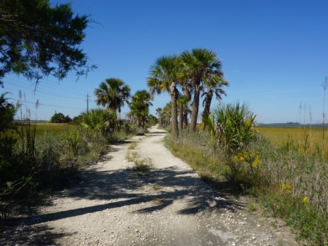
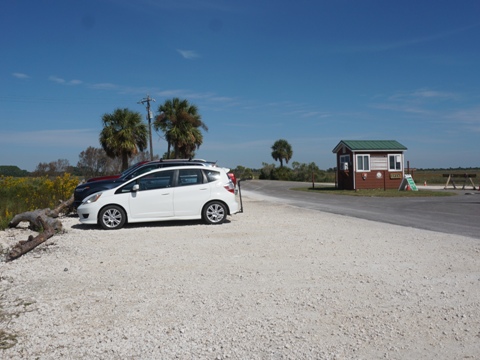
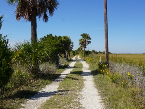
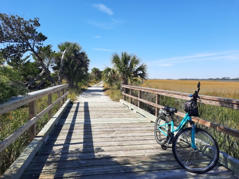
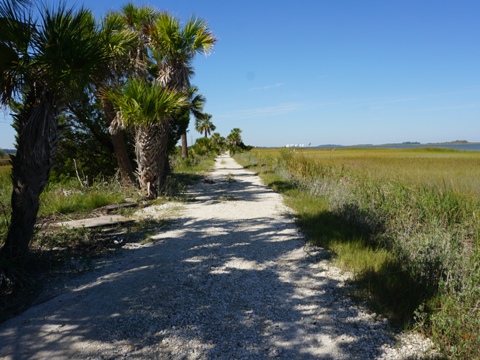
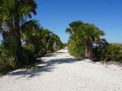
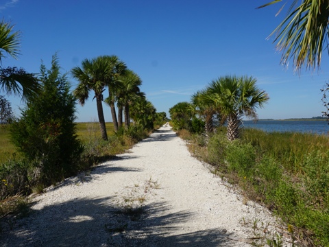
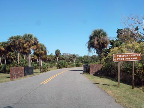
East of Savannah, GA, the McQueen's Island Trail is a 6-mile hardpack & gravel trail, built on a section of railbed of the old Savannah and Atlantic Railroad that ran between Savannah and Tybee Island. The trail begins at the parking area just outside the entrance to the Fort Pulaski National Monument (more below, a worthwhile to-do for bike trippers). From here, the trail runs west for about 6 miles, parallel to the South Channel of the Savannah River. Scenic, but more large gravel approaching the midpoint and beyond, best for wide tires. (Detailed map and photos below)
Location: Chatham County, GA (See map)
Distance: 6 miles
Surface: Composite and crushed stone
Nearby Points of Interest: Fort Pulaski, Tybee Island
Bike Shops/Rentals:
Tybee Island,
see list here

Page Summary:
- Biking on the McQueen's Island Trail
- Trailhead to Midpoint
- At the Midpoint - Fort Pulaski National Monument
- More Information and Resources
Biking on the McQueen's Island Trail... Comments and Photos
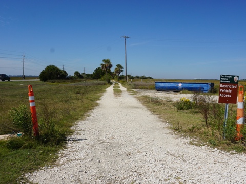
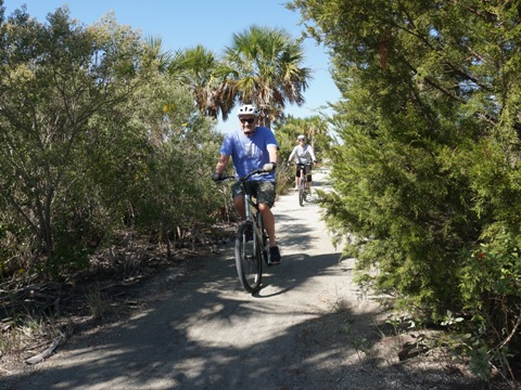
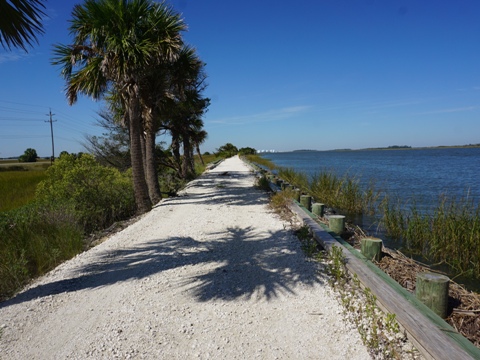
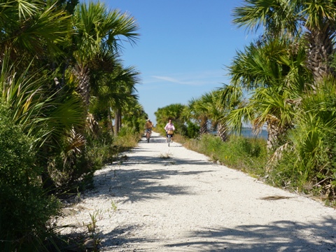
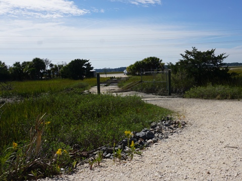
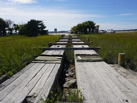
The gravel surface is best enjoyed with wide tire recreational bikes or mountain bikes. Several short boardwalks in the trail cross marsh and offer good views. Benches are located along the way. There are no facilities, and limited shade - bring water and sunscreen. This is an out-and-back ride, as a former mid-trail access point is officially closed (but parking still used by many, unsure of future plans). One downside is, the trail runs alongside US 80 until diverging at the midpoint, so while there's a wide buffer with scenic river and marsh views, there is also consistent road noise in this section.
On this day, we rode the trail east to west from the trailhead to the midpoint and back.
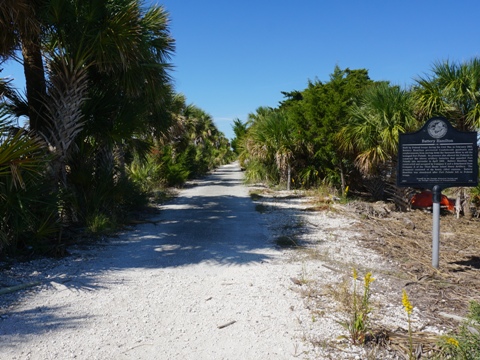
Trailhead to Midpoint
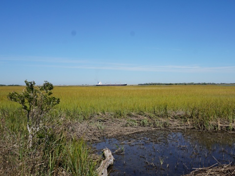
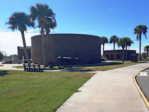
Parking is available at the entrance to Fort Pulaski, no other facilities except at the fort (fee). The trail is a generally easy ride, a few rough spots, but where fewer hikers tread, it becomes increasingly more gravelly approaching the midpoint. Container ships from the Port of Georgia may be seen.

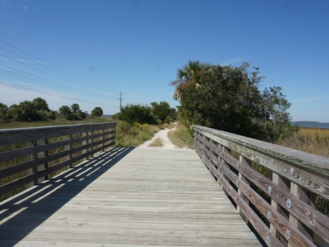
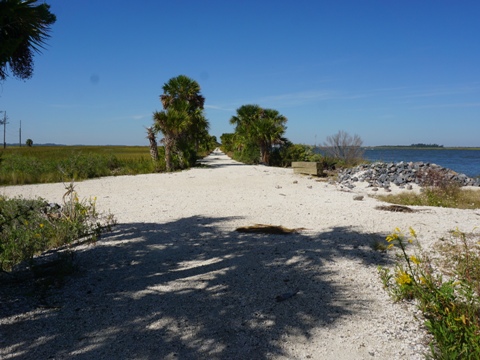
Trail at Midpoint
We ended our ride at the midpoint, where a former parking area was damaged by hurricanes and is now "officially closed," but still used by many. From this point, we returned to start, put our bikes on the rack, and visited Fort Pulaski for history and hiking (below).
Fort Pulaski National Monument
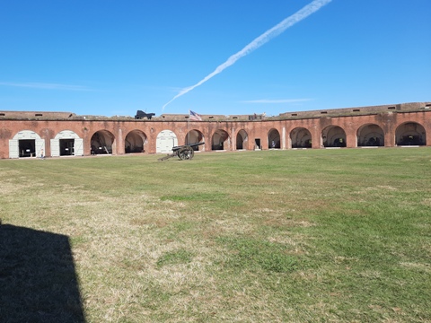
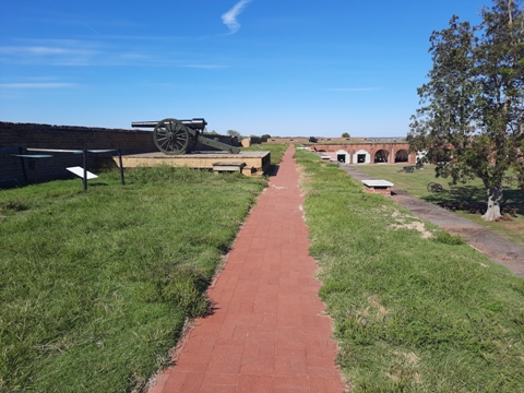
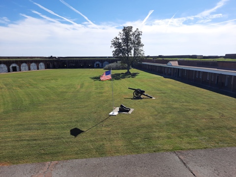
Fort Pulaski National Monument consists of the historic fort with artillery, barracks and other displays, and surrounding 5,300 acre park with visitor center, bookstore, hiking trails and picnicking. Tours available, cannon firings on weekends. National Park fee applies.
History: Fort Pulaski, constructed
between 1829 and 1847 on Cockspur Island near the mouth of the
Savannah River, was originally built to protect Savannah from attack.
During the Civil War, it was occupied by the Confederacy, but fell to
the Union Army in 1862. Thought to be invincible, it succumbed to the
new-technology rifled artillery that breached the walls. After the war,
it fell into disrepair until 1924 when the government declared it a
National Monument. Restored by CCC members in the 1930's, it's now
maintained by the National Park Service. History buffs can
read more here.
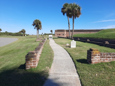
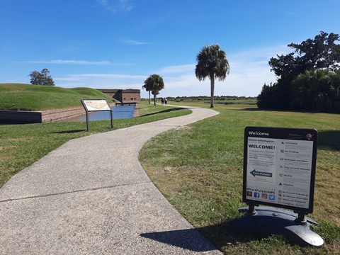
Approaching the Fort
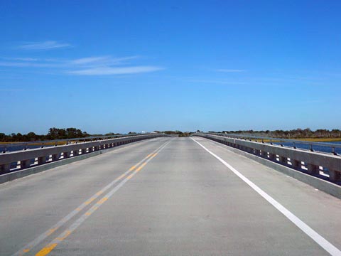
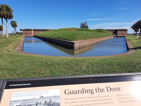
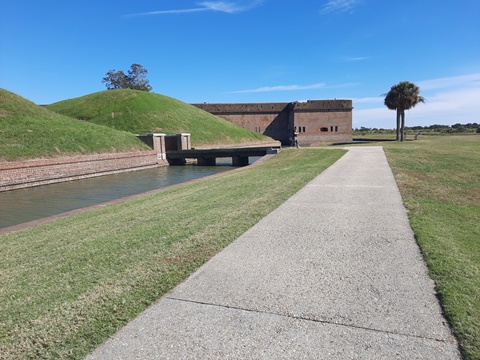
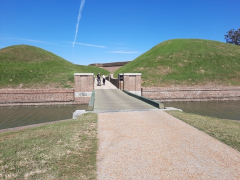
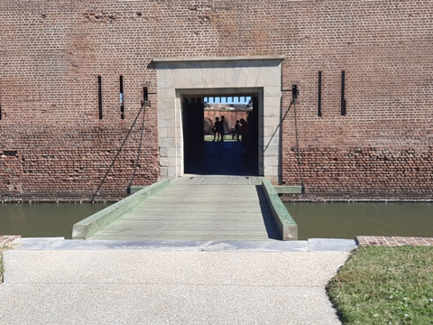
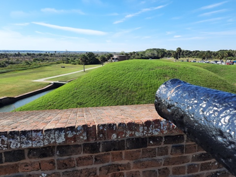
From the entry station off US 80, go over the bridge to Cockspur Island and the National Monument. Ample parking at the Visitor Center. Follow the path to the Fort, passing the demilune, cross the bridge over the moat, then a second bridge to the gate of the fort. This construction was designed to protect the fort's entrance.
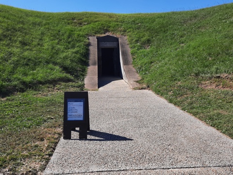
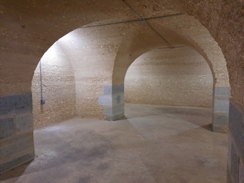
The Demilune (French for "half moon") is a triangular island surrounded by the moat. Originally flat surrounded by a low wall, with cannons, guard house, mess hall and kitchen, in later years the earthen mounds were added to store powder magazines. Tunnels connect beneath, visitors can enter and tour inside.
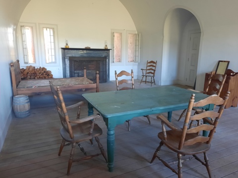
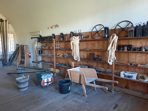
Inside the Fort
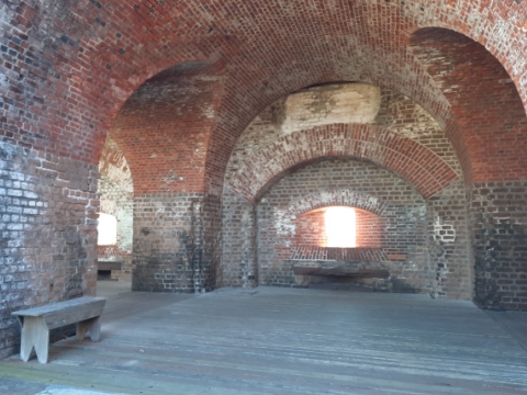
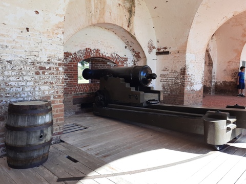
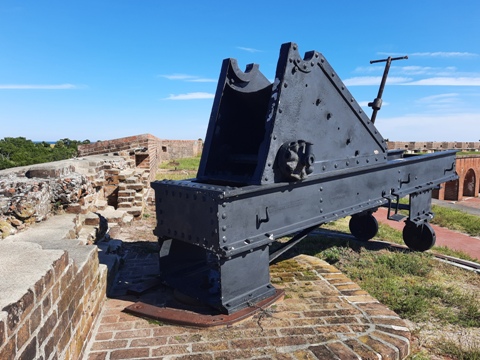
The lower level has the parade grounds, officers and soldier quarters, and the casemates with artillery exhibits. The cannons in the casemates were ineffective, and many casemates were converted into quarters and later a Confederate prison.
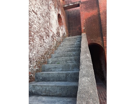
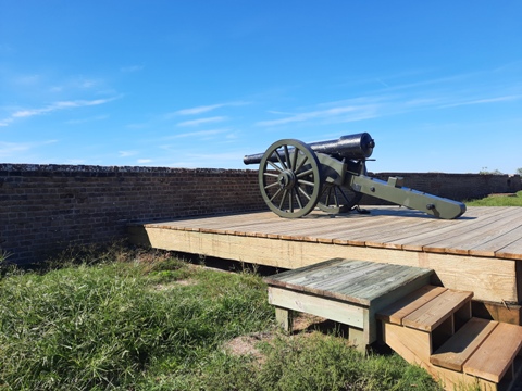
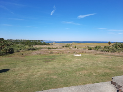
The upper level is reached by stairways at the corners of the fort. Guns were mounted all along the upper level, with some now on exhibit. The surrounding area can be viewed from the top, important to the fort's role as protector.
More Information and Resources
Nearby Biking:
Biking in Savannah
Bike-Georgia - More bike trails in Georgia
Related Resources:
Tybee Island -
McQueen's Island Trail
Chatham County
Parks & Recreation - McQueen's Island Trail
National Park Service - Fort Pulaski National Monument
