Bike Tripper
Have Bikes, Will Travel
Bike Trail Maps & Photos Galore
You are here > Home >
Maine >
Bait Hole Recreation Trails
Reported: September 2019
Bait Hole Recreation Trails...
Biking in Maine
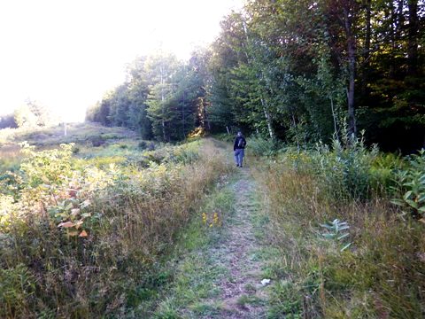
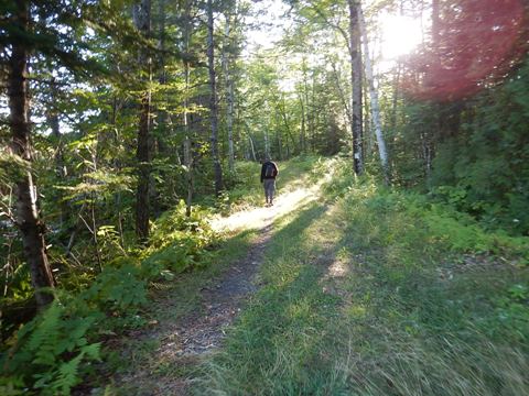
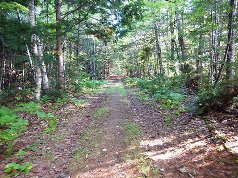
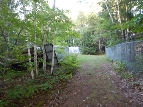
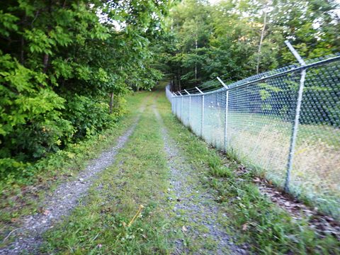
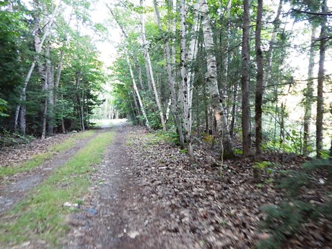
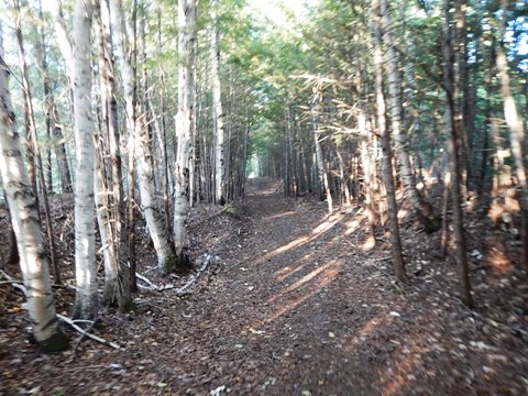
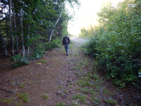
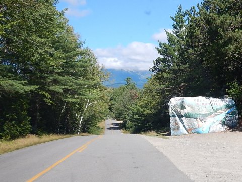
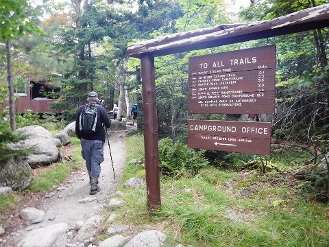
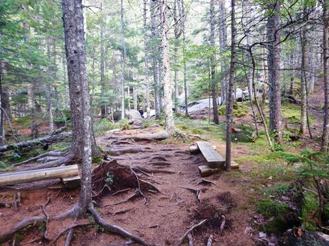
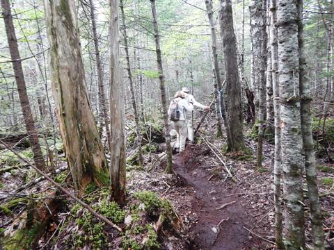
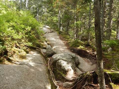
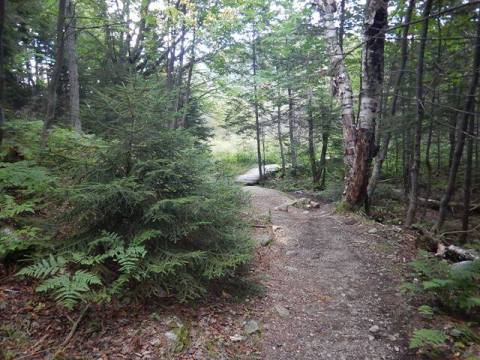
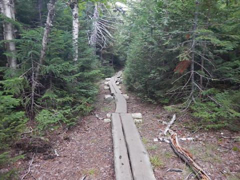
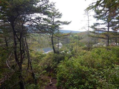
The Bait Hole Recreation Trails near Millinocket, in the Maine Highlands, are a trail network with two loops: Bait Hole Loop (3 miles), and North Twin Dam Loop (1.5 mile). In the summer, hiking and biking are popular; in the winter, cross-country skiing and snowshoeing. Disclosure: We hiked the North Twin Dam Loop, but it's bikeable for fat-wheel bikes. Hiking was our main reason for coming to this area, it's close to Baxter State Park and Mt. Katahdin at the northern end of the Appalachian Trail - whenever we're traveling and cross the Trail, we need to hike at least a portion of it. We found Millinocket to be a pleasant town, and Baxter State Park more than lives up to its description as a "Magnificent Obsession" (more below). (Detailed map and photos below.)
Location: Millinocket, ME (See map)
Distance: 4.5 miles
Surface: Gravel, dirt, grass
Nearby Points of
Interest: Baxter State Park, Mt. Katahdin
Bike Shops/Rentals:
N/A
Support and Advocacy:
Katahdin
Area Trails 
Friends
of Baxter State Park
Bait Hole Recreation Trails
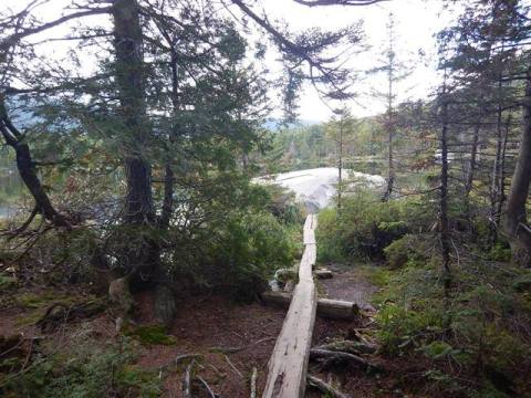
Trailhead to Elbow Lake
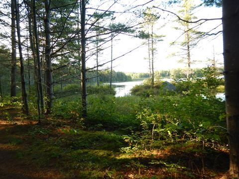
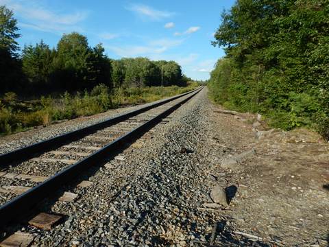
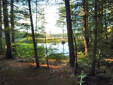
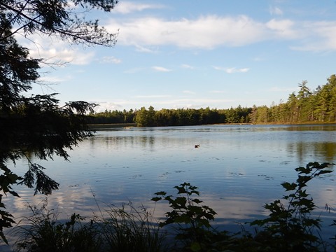
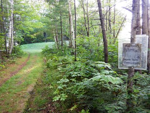
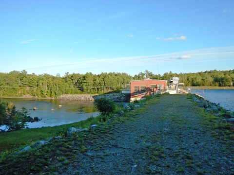
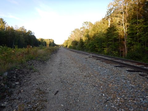
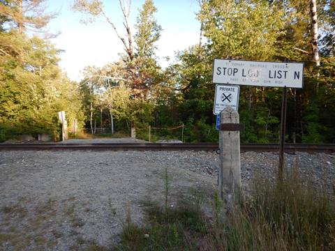
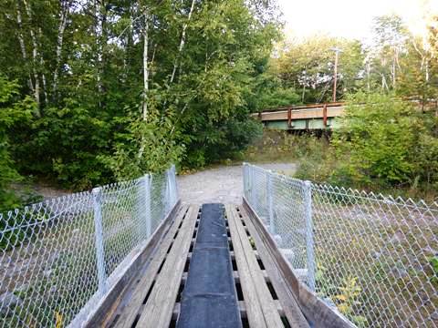
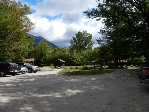
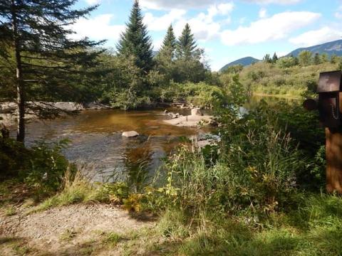
From the parking area, cross the railroad track and onto the trail, both loops run along this section, passing the Bait Hole (a pond once used to keep bait for fishing at Elbow Lake) to scenic Elbow Lake where they diverge. The Bait Hole Loop trail turns north, while the North Twin Dam Loop trail proceeds south to the dam.
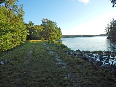
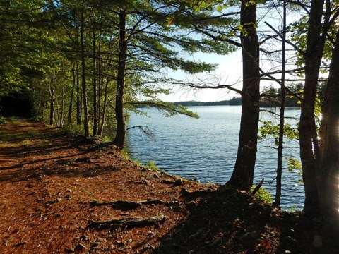
Elbow Lake Return to Trailhead
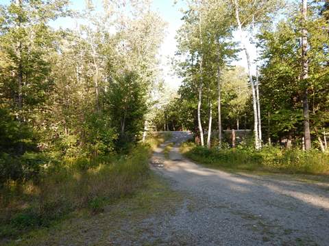
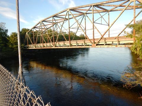
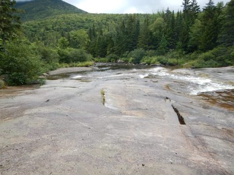
From Elbow Lake, the trail proceeds to the Dam and then along the West Branch Penobscot River and through the woods before coming back to the railroad track. Follow the path to return to trailhead, re-crossing the tracks.
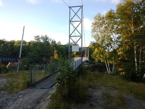
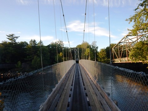
Wiley's Crossing
Maine's longest suspension snowmobile/ATV bridge, paralleling Route 11 and crossing over the West Branch Penobscot River. This abuts the Bait Hole Recreation Areas and we include it because we were there and liked the view.
Nearby Points of Interest
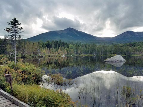
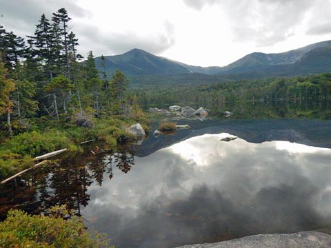
Mt. Katahdin and Baxter State Park
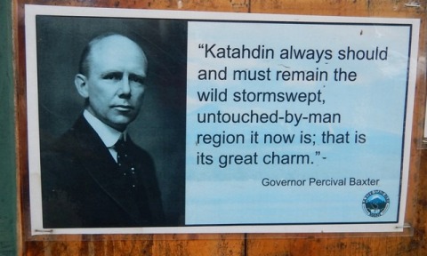 Baxter State Park is a special place. Percival Baxter (Governor 1921-24)
loved the area and started buying land including Mount Katahdin
(highest in Maine) in 1930. Now totaling 210,000 acres, it's
perpetually free to Maine residents funded by a trust left by
Baxter. It's his "Magnificent Obsession" - a well
deserved name. The stunning park has 215 miles of trails
including the portion of the Appalachian Trail to its end at Baxter
Peak on Mount Katahdin - considered the most difficult part of the
Trail (the "hundred mile wilderness" or "horrible hundred") we only
hiked a small portion at the park - about 3-4 miles total. From the
Sandy Stream Trail is a good viewpoint of Mt. Katahdin.
Baxter State Park is a special place. Percival Baxter (Governor 1921-24)
loved the area and started buying land including Mount Katahdin
(highest in Maine) in 1930. Now totaling 210,000 acres, it's
perpetually free to Maine residents funded by a trust left by
Baxter. It's his "Magnificent Obsession" - a well
deserved name. The stunning park has 215 miles of trails
including the portion of the Appalachian Trail to its end at Baxter
Peak on Mount Katahdin - considered the most difficult part of the
Trail (the "hundred mile wilderness" or "horrible hundred") we only
hiked a small portion at the park - about 3-4 miles total. From the
Sandy Stream Trail is a good viewpoint of Mt. Katahdin.
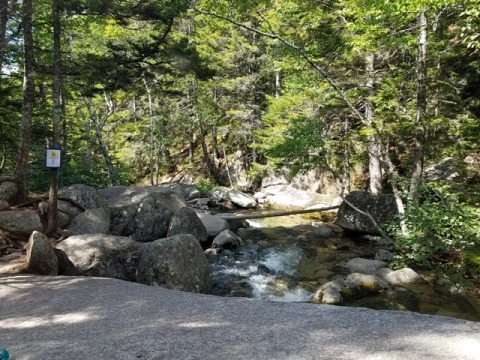
Baxter State Park and Appalachian Trail
We followed a portion of the trail to Katahdin Falls, but elected not to continue over the rocks from there.
More Information and Resources
More Biking:
Bike-Maine - More bike trails and information
about biking in Maine
Related Resources:
Maine Trail Finder - Bait Hole Hiking & Biking Trails
Baxter State
Park

Copyright © BikeTripper.net. All Rights Reserved. Have Bikes - Will Travel