Bike Tripper
Have Bikes, Will Travel
Bike Trail Maps & Photos Galore
You are here > Home >
South Carolina >
Three Rivers Greenway >
Saluda Riverwalk
Reported: June 2023
Saluda Riverwalk, Columbia, SC...
Part of the Three Rivers Greenway Trail Network
The Saluda Riverwalk portion of the Three Rivers Greenway lies in Columbia, South Carolina, running about 3.5 miles along the north shore of the Saluda River (west of the Broad River). The scenic trail is popular with bikers and pedestrians; other activities include fishing, paddling, and birdwatching. Parking, restrooms and picnicking are at the Candi Lane Trailhead. The trail passes Riverbanks Zoo & Gardens, with picnic tables, benches, bridges and boardwalks, emergency call boxes and interpretative markers along the way. The Millrace Rapids near the trailhead are a noteworthy feature. (Detailed map and photos below.)
Location: Columbia, SC (See map)
Distance: 3.5 miles (including loop at Boyd Island
Sanctuary), extensions planned
Surface: Paved, 8-10 feet
Trailhead/Parking: 650 Candi Lane
Nearby Places
of Interest: Riverbanks Zoo &
Botanical Garden
Bike Shops/Rentals:
Cycle Center
 (sales, service)
Blue Bike SC
(bike-share rentals)
Page Summary:
- Biking the Saluda Riverwalk
- Saluda Riverwalk
- Traihead-Millrace Rapids
- South from Trailhead
- North from Trailhead - Boyd Island Sanctuary
- More Information and Resources
Biking the Saluda Riverwalk... Comments and Photos
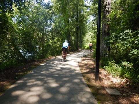
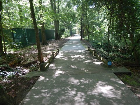
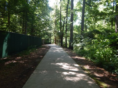
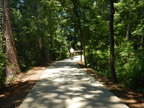
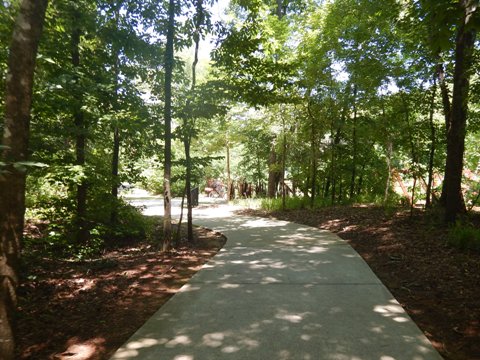
The Saluda Riverwalk is the newest (to date) section of Three Rivers Greenway. It runs totally along the river with no crossroads. This is an easy, mostly shaded ride with scenic river views and wildlife. As other sections of the Greenway, it winds along the riverside and around trees, so bikers do need to watch for curves and pedestrians. To the south, it passes the Riverbanks Zoo & Gardens, and links to the loop trail at Boyd Island Sanctuary where the Saluda River meets the Broad and Congaree Rivers. To the north, it runs closer to US 76/I-126 and a railroad track, ending at I-26. A project is under development to connect to the Columbia Riverwalk via a bridge over the Broad River.
Saluda Riverwalk - 3.5 miles
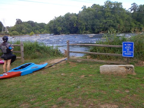
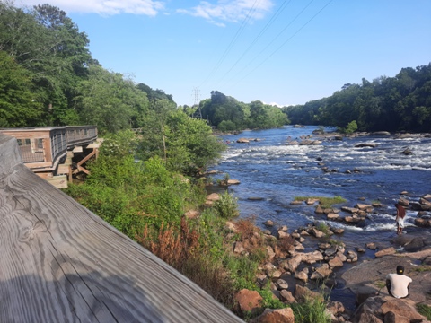
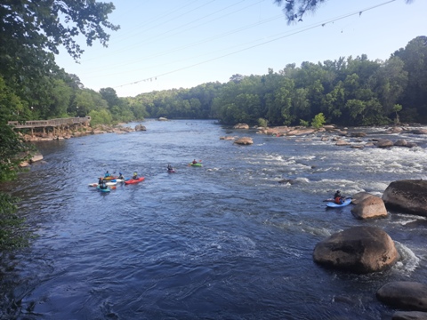
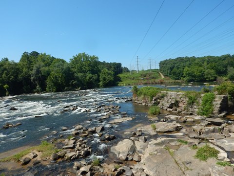
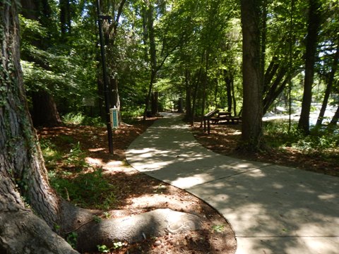
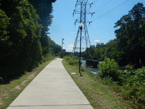
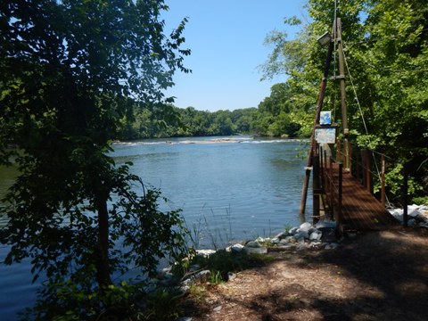
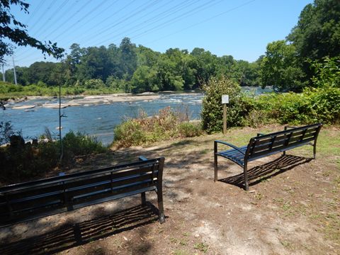
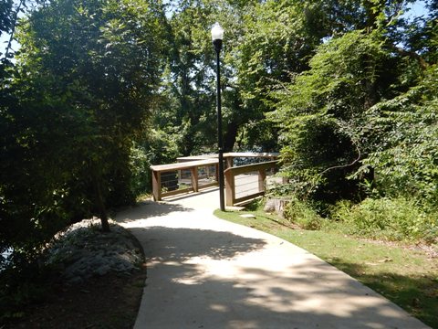
Saluda Riverwalk - Trailhead and Millrace Rapids
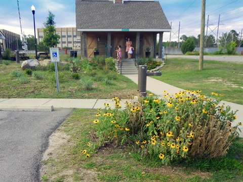
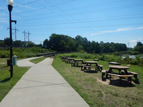
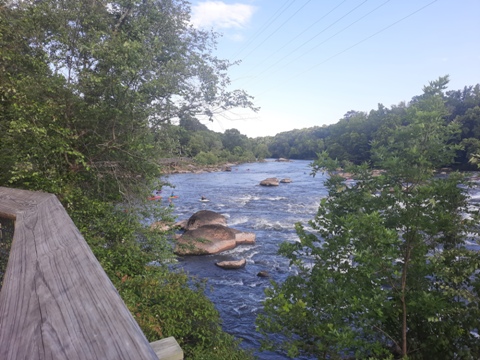
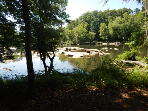
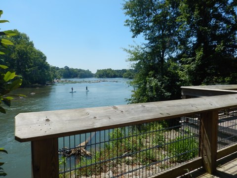
The Saluda Riverwalk Trailhead is located on Candi Lane off US 76/I-126 (near Riverbanks Zoo), with parking and restrooms. Stairs and an accessible ramp lead down the Riverwalk with picnic tables along the river and a paddling take-out. From here is one of the most scenic views along the Three Rivers Greenway... the Millrace Rapids on the Saluda River. A boardwalk along the Riverwalk overlooks the rapids. Many kayakers were bunched at the bottom of the run, some attempting to paddle up (without much luck while we were there). The Class II-III rapids flow over the remains of a twice-dynamited coffer dam, and are a challenge for even the most experienced kayaker (helmet and life jacket required, wetsuit recommended).
Saluda Trailhead


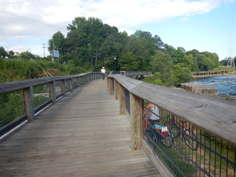
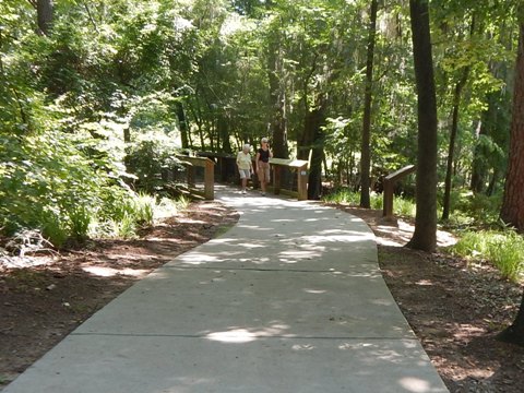
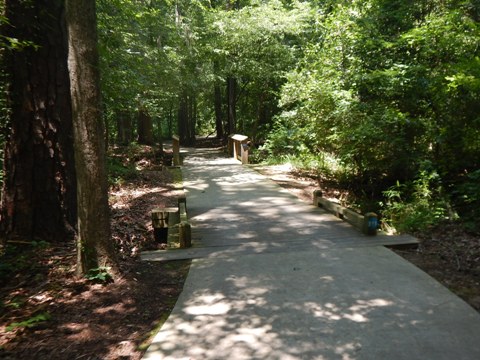
Saluda Riverwalk - South from Trailhead
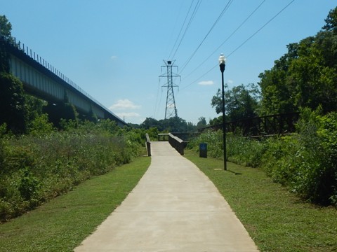
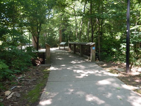
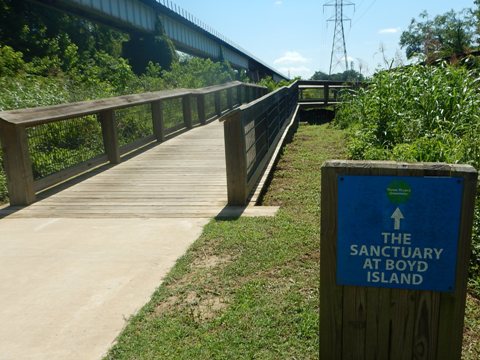
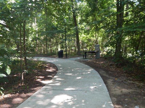
South from the Trailhead, after crossing the boardwalk overlooking the Millrace Rapids, the Riverwalk continues riverside. Looping past the Riverbanks Zoo, it's far removed from the roadway. This section is shaded and scenic with boardwalks, benches, picnic tables, and interpretative historic markers. After passing the zoo, it draws parallel to a railroad track and one of the few unshaded sections. The Saluda Riverwalk ends at bridge crossing to the Boyd Island Sanctuary (more below). This also marks the conjunction of the Saluda, Broad and Congaree Rivers. From here, the Riverwalk eventually will be extended under the railroad and US 76/I-126, with a new bridge planned across the Broad River linking to Columbia Riverwalk.

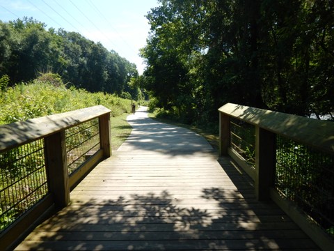
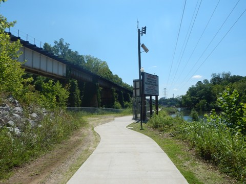
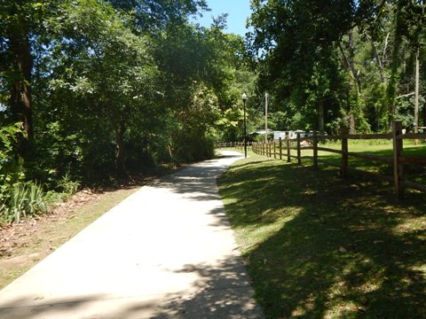
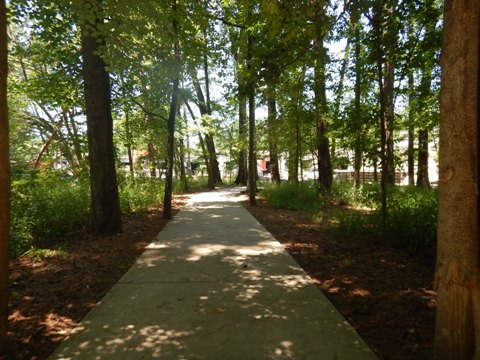
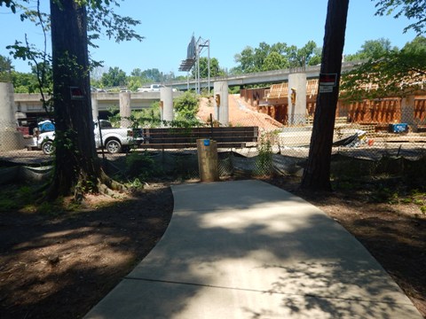
Saluda Riverwalk - North from Trailhead
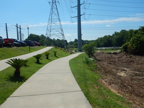
From the trailhead north, the Riverwalk runs parallel to US 76/I-126 and a railroad track. The road view is mostly blocked by vegetation, but with road noise (more or less, depending on wind direction and distance from roadway). The trail winds riverside, with scenic views and boardwalks, also passing a small residential area. Interpretative markers describe the flora and fauna, historical markers tell of the historic Saluda Canal which was built to bypass rapids on the river but closed in 1837 as railroads became prevalent. Construction was underway at I-26, marked with a "temporary trail end" sign.
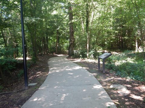
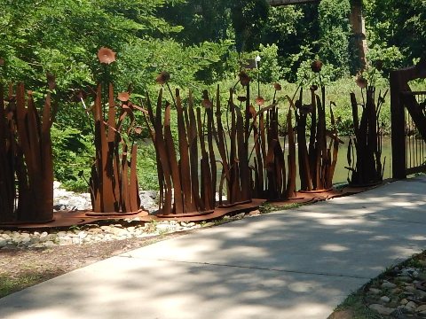
Boyd Island Sanctuary
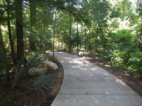
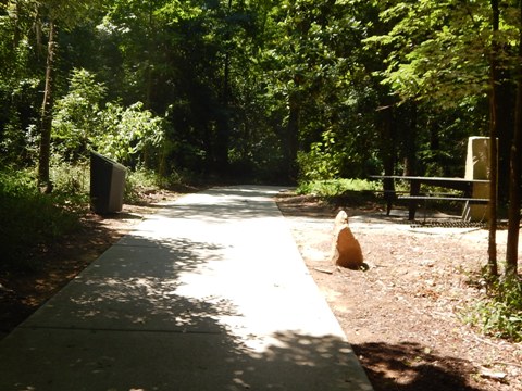
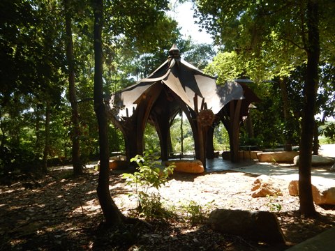
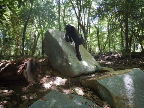
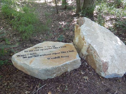
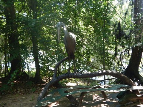
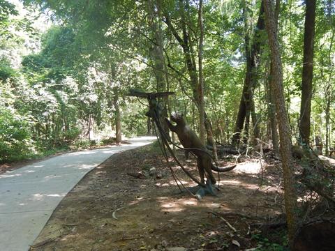
Boyd Island is a 7-acre island at the junction of the Saluda, Broad and Congaree Rivers. Previously only accessible by water or a waterlogged trail, it's now connected to the Saluda Riverwalk via a bridge. This is a pleasant get-away, with a loop trail (about 1/2 mile) suitable for biking and walking. Benches, picnic tables, gazebo, a variety of native plants, and public art installations have been added. An overlook provides a view of the three rivers' conjunction.

More Information and Resources
More Biking:
Three Rivers Greenway-Overview
- Columbia Riverwalk
- Cayce-West Columbia Riverwalk
- Saluda Riverwalk
Bike-South Carolina
- More information about biking in South Carolina
Related Resources:
The River Alliance - Saluda Riverwalk
South Carolina Dept. of Natural Resources - Saluda Riverwalk
Support and Advocacy:
The
River Alliance

Copyright © BikeTripper.net. All Rights Reserved. Have Bikes - Will Travel