Bike Tripper
Have Bikes, Will Travel
Bike Trail Maps & Photos Galore
You are here > Home >
South Carolina >
Three Rivers Greenway
Latest update: June 2023
Three Rivers Greenway... Greater Columbia, SC
Biking the 3 Greenway Riverwalks - Trail Map & Photos Galore
The Three Rivers Greenway consists of 3 separate "riverwalks" (currently not connected), totaling about 14.5 miles of mostly easy biking. Each offers a different ride experience: (1) Columbia Riverwalk along the Broad River, (2) Cayce - West Columbia Riverwalk along the Congaree River, and (3) Saluda Riverwalk along the Saluda River. All feature pleasant scenery and good signage. (Detailed map, photos below.)

Location: Greater Columbia, SC (see map)
Distance: Best for biking 14.5 miles, total
paved 18 miles
Surface: Paved Asphalt, 8-10 feet
Support and Advocacy:
The
River Alliance 
Bike Shops/Rentals:
Cycle Center
(sales, service)
Blue Bike SC
(bike-share rentals)
Best Biking... 3 Riverwalks of the Three Rivers Greenway
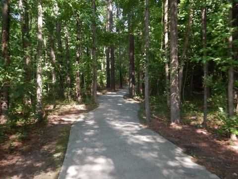
Below are brief overviews of the 3 longest and best biking sections (with links to full-page descriptions). All are paved asphalt, 8-10' wide. The Greenway layout can be confusing, so our Google map may be useful in planning your ride. (The map also helps to envision the future connections.) All riverwalk trail sections are lighted, and well marked, with call boxes, restrooms, historic sites, exhibits, picnic areas, and many scenic water views. Note: Portions may be closed at times due to heavy rains or maintenance.
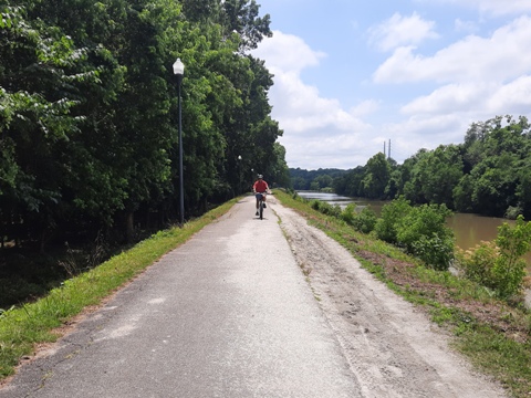
Columbia Riverwalk - Located in Columbia, SC, best biking is 3 miles. (Other sections not yet connected.)
- Runs along a long, narrow island between the Broad River and Columbia Canal on a levee built in the early 1800s.
- Long straightaways make this riverwalk popular with road bikes.
- Where the island widens, a 1-mile hiking trail goes through lowlands.
- From the tall levee, we spotted numerous deer in this area.
- More open than the other riverwalks, best shade is later in the day.
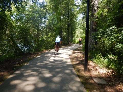
Cayce - West Columbia Riverwalk - Located in West Columbia and Cayce, SC, about 8.5 miles including Timmerman Trail.
- Runs along the west side of the Congaree River.
- Built to conserve the larger trees, the trail weaves almost continuously, with no long straightaways.
- The northern side of the riverwalk (1st mile) is often congested, especially on weekends
- At the south end, it connects seamlessly the Timmerman Trail, which loops through the Congaree Creek Heritage Preserve.
Saluda Riverwalk - Located in Columbia, SC, about 3.5 miles along the north shore of the Saluda River.
- Located west of the Broad River, the water is cold and clear.
- Great views of the rapids at Riverview Park.
- The trail links to Boyd Island Sanctuary (worth a look) and passes Riverbanks Zoo & Garden.
- Conserving the larger trees, this riverwalk weaves continuously, but perhaps less so than its southern cousin.
More Information and Resources
More Biking:
Bike-South-Carolina
- More about bike trails in South Carolina
Related Resources:
The
River Alliance - Three Rivers Greenway
Experience Columbia - Three Rivers Greenway

Copyright © BikeTripper.net. All Rights Reserved. Have Bikes - Will Travel