Bike Tripper
Have Bikes, Will Travel
Bike Trail Maps & Photos Galore
You are here > Home >
South Carolina >
Three Rivers Greenway >
Columbia Riverwalk
Reported: June 2023
Columbia Riverwalk, Columbia, SC...
Biking and Hiking part of the Three Rivers Greenway
The Columbia Riverwalk is located in Columbia, SC, and is part of the Three Rivers Greenway trail network. Currently, the Columbia Riverwalk consists of three disconnected sections (see map), but the best section for biking and hiking is the scenic 3-miles on an island between the Columbia Canal and Broad River (parking at both ends). Future plans call for connections to the Cayce-West Columbia Riverwalk along the Congaree River, and Saluda Riverwalk along the Saluda River. (Detailed map and photos below.)
Location: Richland County, SC (Columbia) (See map)
Distance: 3 miles of continuous biking (additional 2.5 miles currently not connected)
Trailheads: Riverfront Park North, Riverfront Park
South, Gervais St., Granby Park, Olympia Park
Surface: Paved, 8-10 feet
Nearby Places of
Interest: South Carolina State Capitol, University of South Carolina
Bike Shops/Rentals:
Cycle Center
 (sales, service)
Blue Bike SC
(bike-share rentals)
Page Summary:
- Bikng the Columbia Riverwalk
- Along the Columbia Canal
- Riverfront Park-South Trailhead
- South Trailhead to Broad River Trail
- Broad River Trail to North Trailhead - More Riverwalk in Columbia
- Two disconnected sections - More Information and Resources
Biking Columbia Riverwalk... Comments and Photos
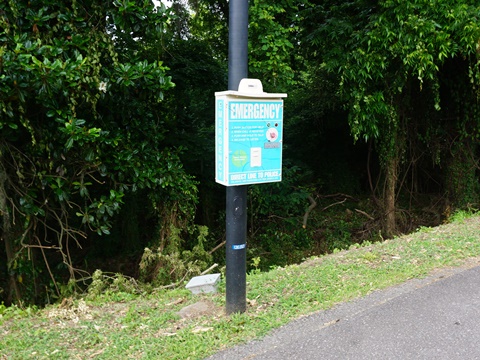
The trail is lighted and well marked, with a lot of shade and scenic river views. Rest stations, picnic areas, restrooms, historic sites and exhibits, and emergency call boxes are located along the way. It consists of three disconnected sections, totaling about 5.5 miles but growing as connections are completed. Eventually, it also will connect to the Cayce-West Columbia Riverwalk along the Congaree River, and Saluda Riverwalk along the Saluda River. Note: Portions may be closed from time to time due to maintenance or weather.
Along the Columbia Canal - 3 miles
We visit the Columbia Canal Section of the Riverwalk from South to North
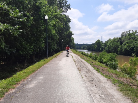
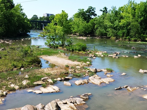
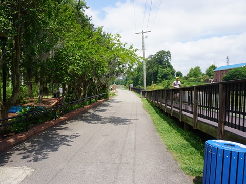
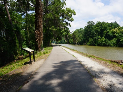
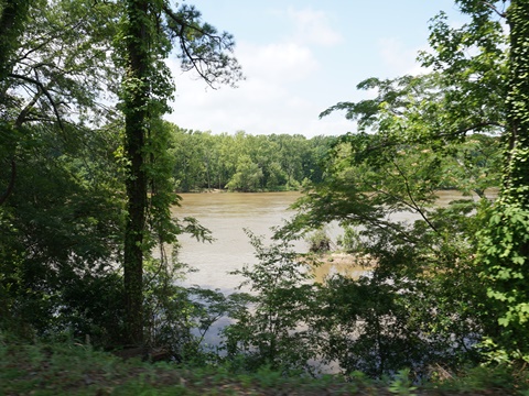
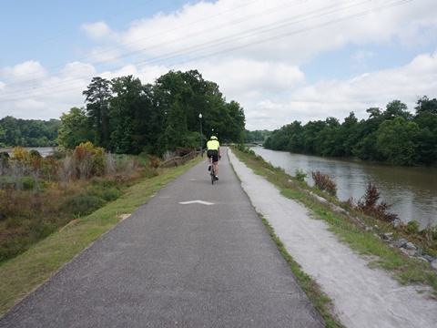
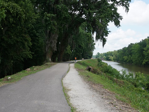
This section of the Columbia Riverwalk follows the old towpath on the levee along the Columbia Canal, parallel to the Broad River. It runs at Riverfront Park from its south entrance (312 Laurel St.) to the north entrance (4120 River Dr.) with both river and canal views. Riverfront Park was built around the site of Columbia's original waterworks (the oldest in the state, and still in operation). The park runs along the Columbia Canal, with access to the Columbia Riverwalk at each end. The trail is well maintained, mostly straight and flat. Road bikers will find this easiest to ride, but do watch for pedestrians - particularly near the Amphitheater and waterworks.
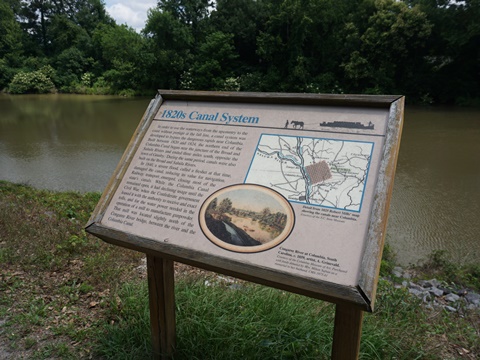
History: The Columbia Canal was built in the 1800's as a way for ships to bypass the rapids on the rivers, its use was diminished as railroads became the main means of transit.
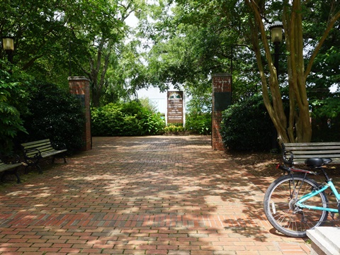
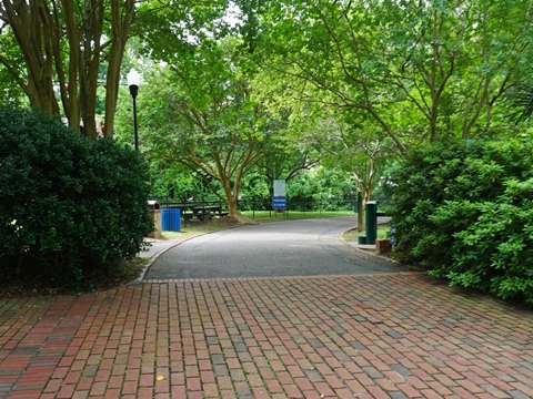
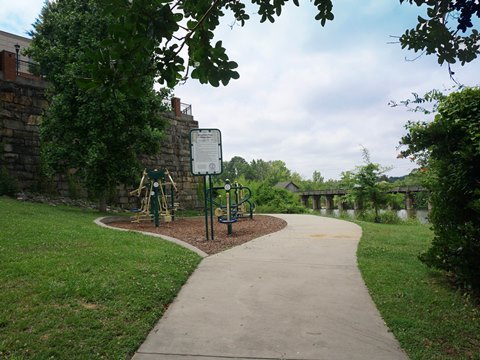
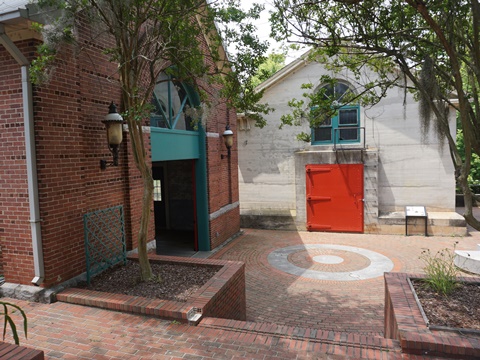
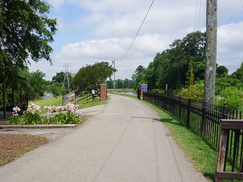
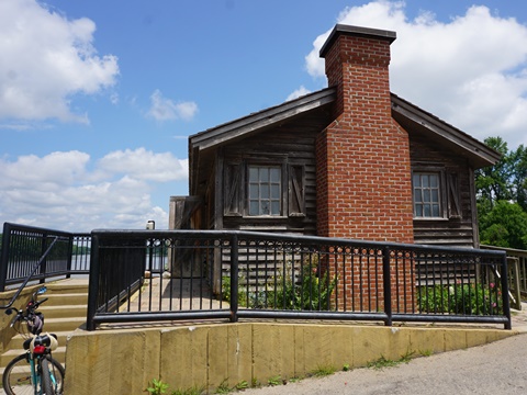
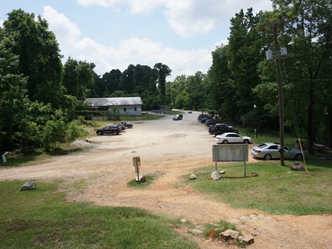
Riverfront Park - South Trailhead
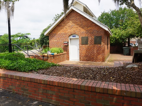
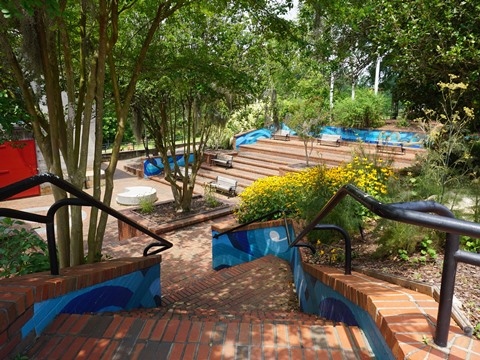
At the south trailhead are parking, restrooms, bike-share station, playground, and ranger offices with exhibits describing the history of the waterworks and canal. A short trail runs about 1/4 mile from parking to a bridge crossing to the Riverwalk, on the west side of the canal. Here are the Riverfront Park Amphitheater and 1906 hydraulic turbine house (exhibits).

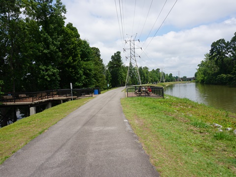
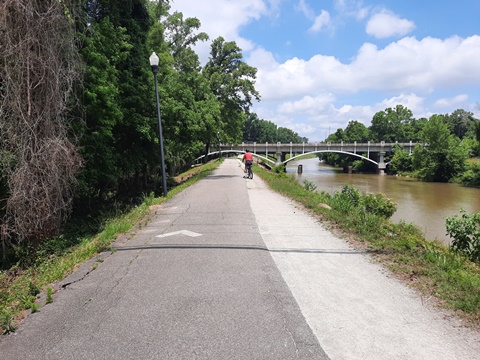
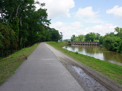
South Trailhead to Broad River Trail
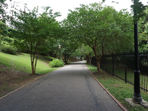
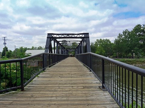
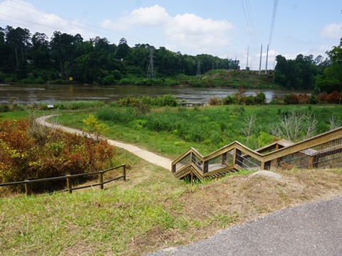
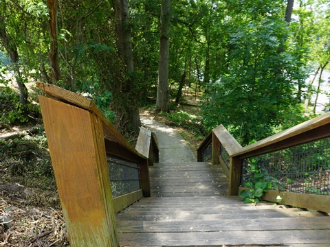
From the bridge at the south trailhead, turn right (north) onto the Riverwalk, following the canal. (Note: from here, the Riverwalk also runs south about 4/10 mile to the end of the canal, but it was shut for maintenance on our visit.) We found this section easy to ride, flat and mostly straight, but with less shade. Along the way are benches, picnic tables, historical markers, and viewing areas of both canal and river. A set of stairs runs down to the Broad River - this is the beginning of the Broad River Trail, a parallel walking path to the north trailhead (one mile).
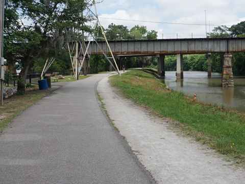
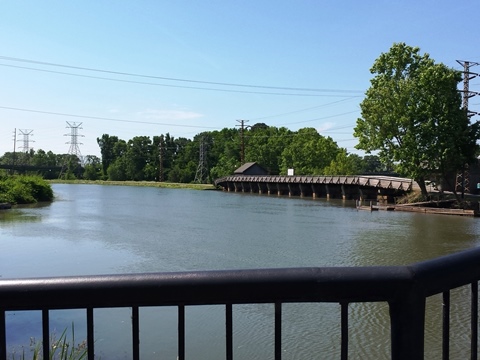
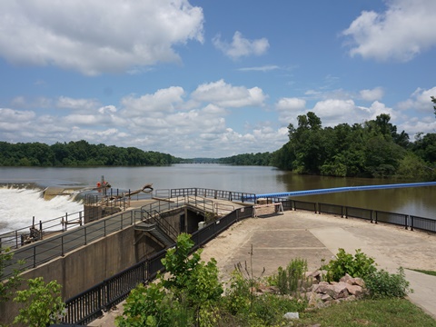
Broad River Trail to North Trailhead
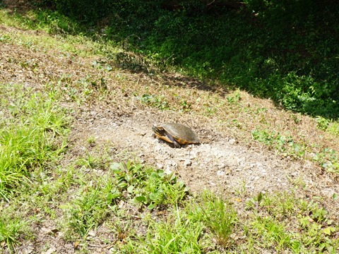
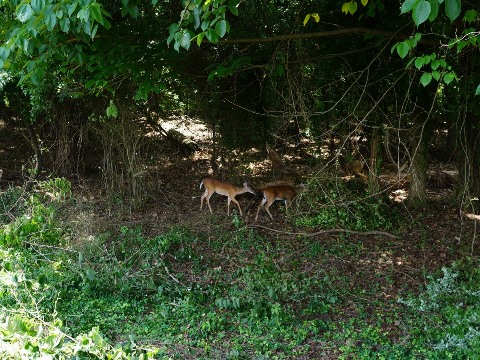
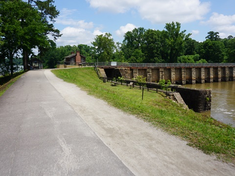
At the north trailhead are parking and restrooms at the site of the 1891 diversion dam, still in use, providing water from the Broad River to the Columbia Canal (exhibits). Wildlife in this section included birds, deer, and turtles, signs warned of alligators but we saw none.

More Riverwalk in Columbia - 2.5 miles
There are two additional, disconnected sections in Columbia, to the south near the University (see map):
- One segment runs along Washington St., about 1/2 mile past the South Carolina State Museum to the Gervais St. Bridge trailhead, along the Congaree River across from West Columbia
- A second segment starts at Granby Park near Founders Field (USC baseball stadium). Starting along the Congaree River across from Cayce, it then turns off the river, past apartments (serving the University), to Olympia Park, about 2 miles. This is the southernmost section of Columbia Riverwalk.
More Information and Resources
More Biking:
Three Rivers Greenway-Overview
- Columbia Riverwalk
- Cayce-West Columbia Riverwalk
- Saluda Riverwalk
Bike-South Carolina
- More information about biking in South Carolina
Related Resources:
SC Trails - Riverfront Park & Historic Columbia Canal
The
River Alliance - Three Rivers Greenway
Experience Columbia - Three Rivers Greenway
Support and Advocacy:
The
River Alliance

Copyright © BikeTripper.net. All Rights Reserved. Have Bikes - Will Travel