Bike Tripper
Have Bikes, Will Travel
Bike Trail Maps & Photos Galore
You are here > Home >
Georgia >
Augusta Trails >
Augusta Riverwalk
Reported: October 2023
Augusta Riverwalk...
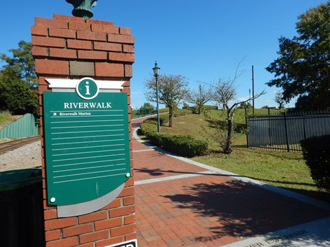
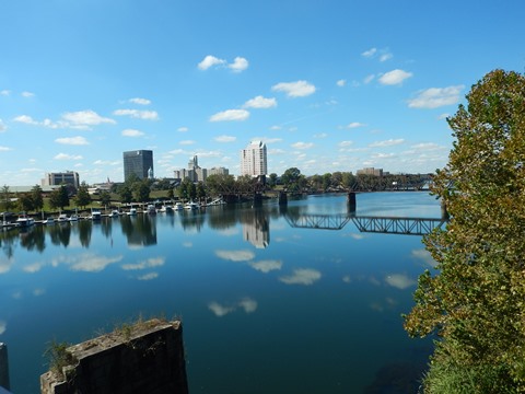
A Popular Riverfront Park
The Augusta Riverwalk runs in downtown Augusta along the Savannah River from 6th St. to 13th St. Located on two levels (the lower alongside the river, and the upper on the river levee), there are several access points to each. Popular for biking, walking and running. The Riverwalk connects to parks and museums, with many events staged throughout the year. Interpretative markers tell of the area's history. As a bonus, proceed past the Marina to 5th St. and cross the Freedom Bridge connecting Georgia and South Carolina. (Detailed map and photos below.)
Location: Augusta, GA (See map)
Distance: 2 miles
Surface: Brick paved
Trailheads/Parking:
5th St. Marina, street parking; parking lots: 509 Reynolds St. (6th
St.), 6 James Brown Blvd, (9th St./amphitheater)
Nearby Places of Interest: Augusta Museum of History,
Morris Museum of Art, Broad St. Historic District
Bike Shops/Rentals:
The Bicycle Peddler  (rentals, sales, service)
Andy Jordan's
Bicycle Warehouse
(rentals, sales, service)
Outspokin' Bicycles
(sales, service, group rides)
5th St. Marina
(rentals)
Page Summary:
- Biking on the Augusta Riverwalk
- Upper Riverwalk
- Lower Riverwalk - Freedom Bridge
- More Information and Resources
Biking on the Augusta Riverwalk... Comments and Photos
Augusta Riverwalk is paved and easy to ride, though there were a few spots needing repair, so do stay alert. Watch for pedestrians. We recommend biking on the upper level, the lower level is more narrow and curving, better for walking. Note: Some have commented on the homeless along the Riverwalk - we saw some homeless on the lower level but no one approached us.
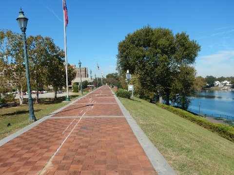
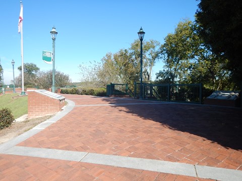
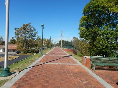
Upper Riverwalk (1 mile)
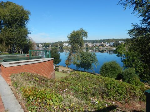
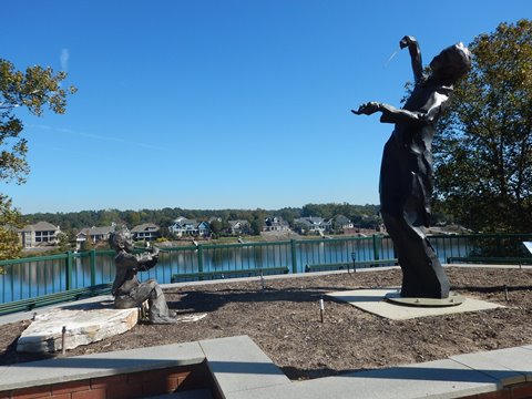
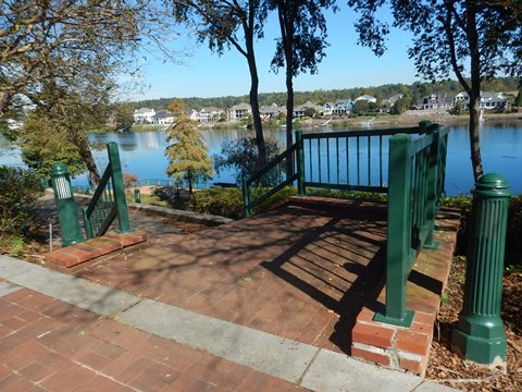
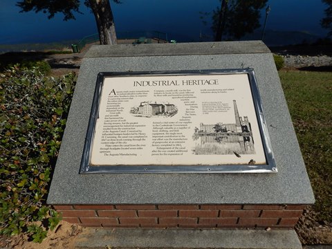
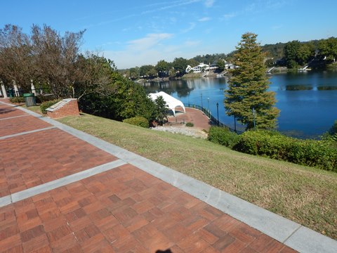
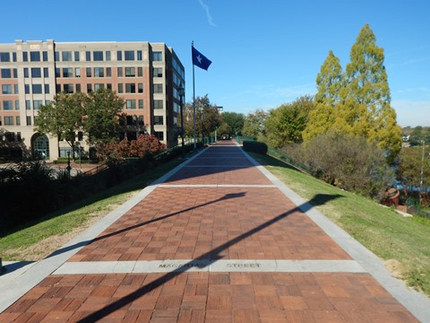
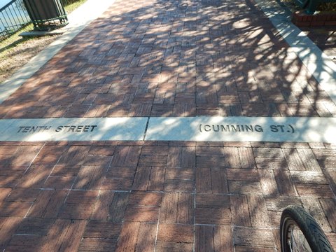
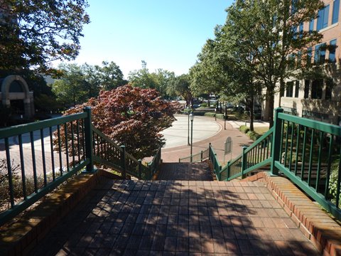
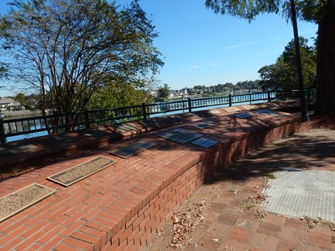
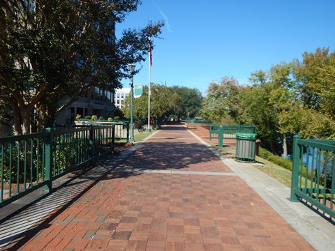
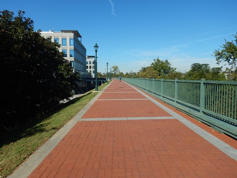
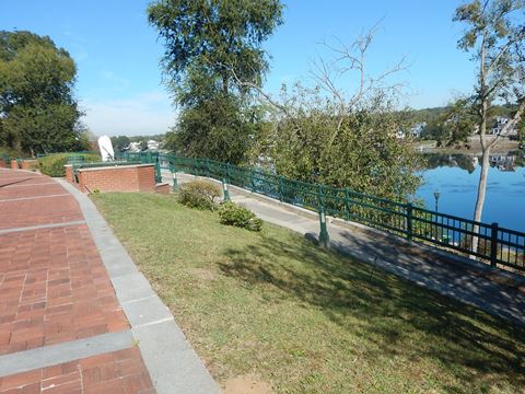
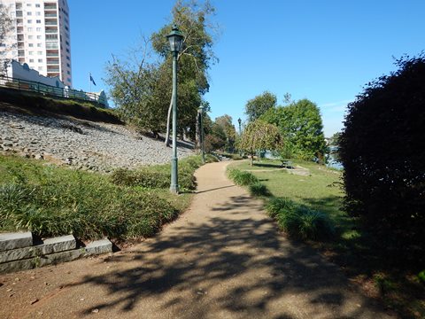
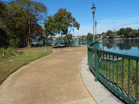
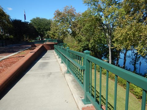
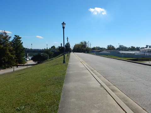
The upper level runs from 6th St. to 13th St., reached from the street by stairways and ramps at 6th Street, 8th Street Plaza, and 10th Street. The brick-paved pathway is wide and easy to ride, but unshaded. Benches, viewing areas and historical markers are located all along the way. Several artworks, part of the Augusta Sculpture Trail, line the way. Street names are embedded in the pavement, especially helpful at access points.
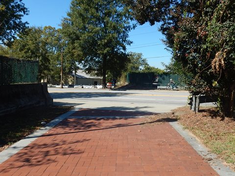
6th to 10th Street
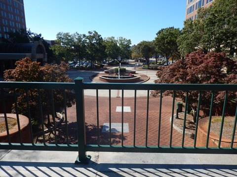
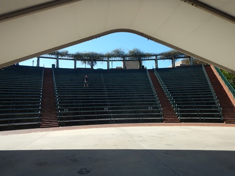
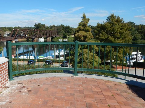
Our visit starts at 6th St., near the Marina. Parking is available along 6th St., or at the 509 Reynolds St. parking lot (free). From the street level, go up the ramp to the left of the train track (the right goes to the Marina - more below). This section passes the 8th St. Plaza and Bulkhead with excellent river views. The Jessye Norman Amphitheater can be accessed at the 9th St. Plaza (or from the lower level).
10th to 13th Street
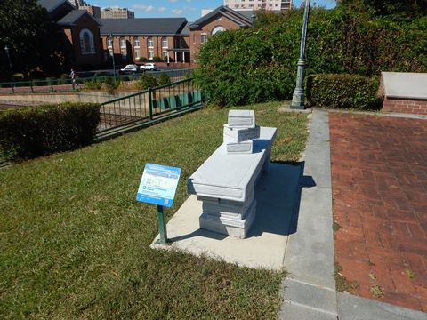
At 10th Street, the Plaza is located between the Marriott Hotel and Morris Museum of Art. A ramp on the river side leads to the Heroes Overlook, honoring members of the community who won the Congressional Medal of Honor, the Distinguished Service Cross, or Navy Cross. Past here to 13th St. is the newest section of the Riverwalk, formerly the unpaved New Bartram Trail. At 13th Street, cross the road to continue on the River Levee Trail.


Lower Riverwalk (0.75 mile)
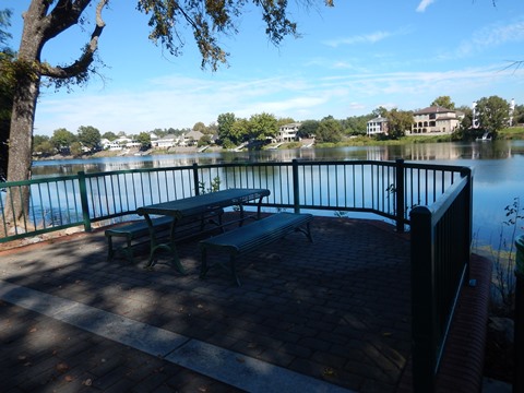
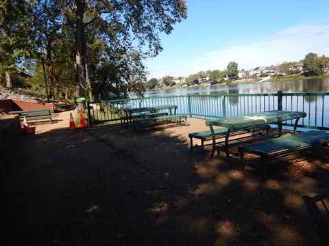
The lower level runs from 6th St. to 10th St. with access via stairways and ramps near the Sixth Street Railroad Bridge, at 8th Street Plaza, the Jessye Norman Amphitheatre, and 10th St. Plaza (in front of the Augusta Marriott). Here, we visit starting at 6th St. The lower level is more shaded, with benches, picnic tables and viewing areas. As noted above, the pathway is more narrow and winding.
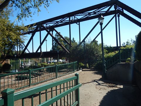
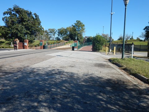
Freedom Bridge
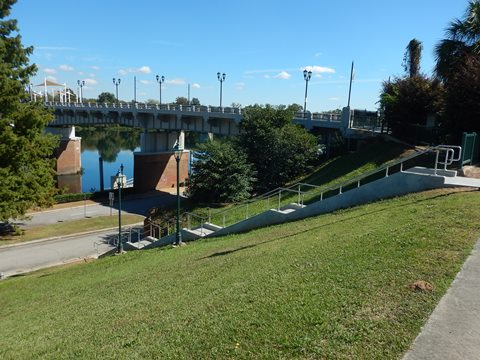
Passing the Marina
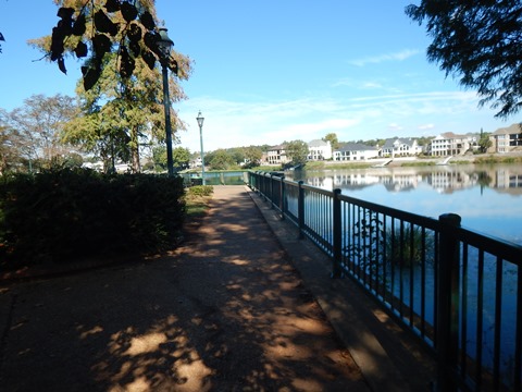
At 6th St. take the ramp to the right of the tracks, the pathway runs on the levee overlooking the Marina. Stairs and a road lead down to the Marina (parking, restrooms, bike and kayak rentals and gift shop). The pathway ends at the road to the Marina - go straight on the road or sidewalk, about 350 feet to 5th St. and the Freedom Bridge,

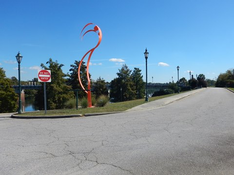
Freedom Bridge (0.25 mile)
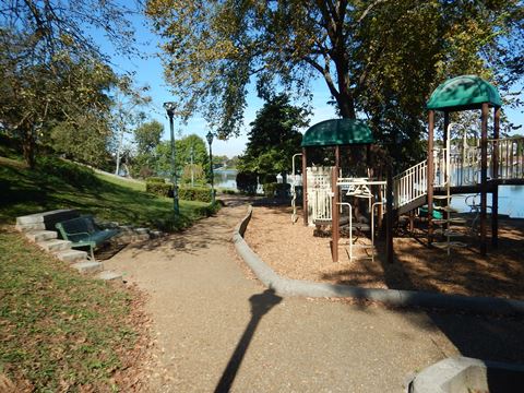
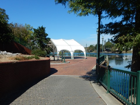
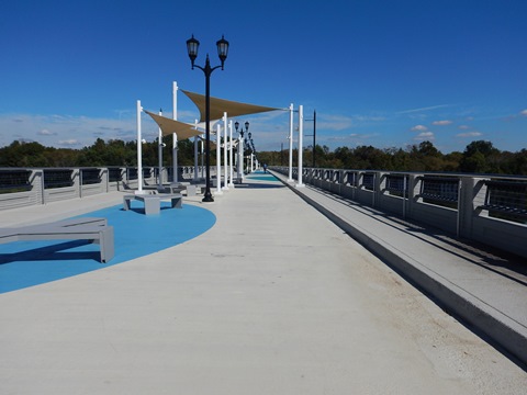
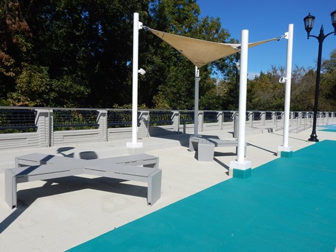
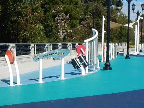
The Freedom Bridge starts at 5th St. and crosses the Savannah River to South Carolina with excellent views, benches and covered seating, water fountains, and children's play area. Wi-Fi is available, and four charging stations for personal devices. Portable toilets are located outside the Augusta (Georgia) entrance. There is currently no development on the North Augusta (South Carolina) side.
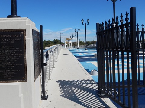
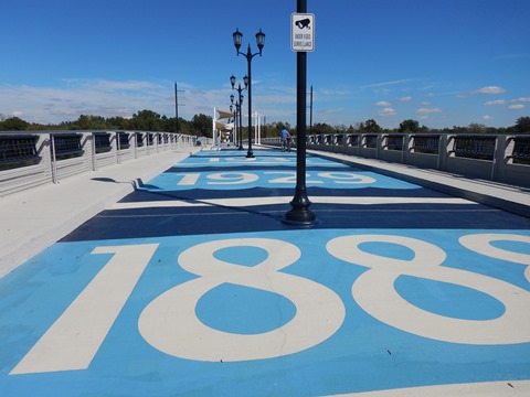
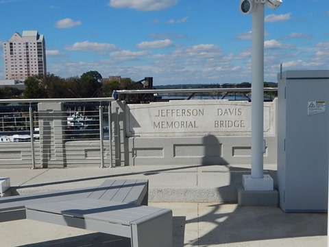
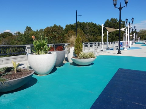
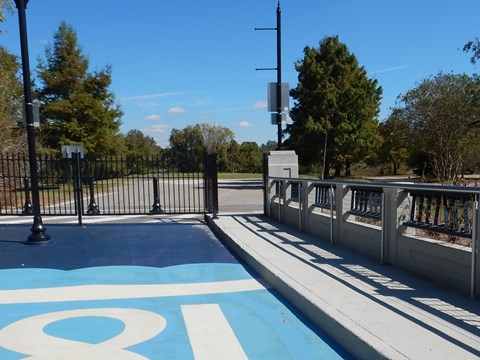
History: Important dates in the bridge's history are painted on the pavement. The original bridge was damaged by floods in 1888 and 1929, and rebuilt in 1931. Named the Jefferson Davis Memorial Bridge (also called the 5th Street Bridge), it was redeveloped from a vehicle to a pedestrian bridge and re-opened in 2022. Now renamed the Freedom Bridge, signage remains remembering the Confederate past.
More Information and Resources
Nearby Biking:
More Augusta Bike Trails:
- Augusta Canal Trail
- River Levee Trail
North Augusta Greeneway (SC)
Bike-Georgia - More bike trails and information about biking in Georgia
Related Resources:
Augusta Recreation and Parks - Augusta Riverwalk

Copyright © BikeTripper.net. All Rights Reserved. Have Bikes - Will Travel