Bike Tripper
Have Bikes, Will Travel
Bike Trail Maps & Photos Galore
You are here > Home > New York > Empire State Trail
Empire State Trail... 750 Miles in New York State
"Connecting New York’s extraordinary experiences, people, and places"
The Empire State Trail (EST) is a trail system spanning New York State from Manhattan north to Albany, and then from Albany west to Buffalo and north to the Adirondacks and Canadian border. Totaling about 750 miles, it's the longest multi-use state trail in the U.S. The EST was built utilizing existing trails owned by various local entities, with new sections and connectors added, and improved surfaces as needed (ongoing). Much of the route follows rail-trails built on old railroad beds. Other sections are on canal paths along the Erie and Champlain Valley Canals. It's a destination both for long-distance bikers on multi-day trips, and for more casual visitors on day-trips to take in the many natural and historic sites, interesting communities, and activities including biking, hiking, boating and paddling, horseback riding, picnicking, camping, skiing and snowshoeing. (Detailed map and photos below.)
Location: New York State - Manhattan to Albany,
Albany to Buffalo,
and Albany to Canadian Border (See map)
Distance: 750 miles
Surface: Paved asphalt, stonedust, some on-road; 10-12 feet
Bike Shops/Rentals:
View full list of bike shops along the Empire State Trail

Also see individual pages in the links below.
Page Summary:
- Biking the Empire State Trail
- Hudson River Valley Greenway
- Manhattan to Albany - Erie Canalway Trail
- Albany to Buffalo - Champlain Valley Greenway
- Albany to Canadian border - More Information and Resources
Biking the Empire State Trail... Comments and Photos
The trail is described in three sections pictured as a sideways "T" - the Hudson River Valley Greenway Trail, the Erie Canalway Trail, and the Champlain Valley Greenway Trail. The trail is generally flat, and easy to ride with paved asphalt and unpaved stonedust portions, and some sections on the road. The trail route passes through large cities and their suburbs, small towns, and rural areas. Open year-round with many access points and trailheads with parking and restrooms. Excellent signage along they way, plus historical information. Restaurants, shopping, and accommodations are available in nearby cities and villages, plus camping in more remote areas and parks. Be prepared with water and snacks, and for rain or other weather conditions.
We've visited some sections, as shown below, and will add more on future visits. There's a lot to cover - more than we can do here - but the State of New York website is an excellent resource for trip planning, with detailed information and routing for each section (see Related Resources, below).
Hudson River Valley Greenway Trail
This section runs from Battery Park at the tip of Manhattan north to Albany, about 210 miles along the Hudson River. It incorporates several trails owned and operated by local entities, those we visited to date are shown.
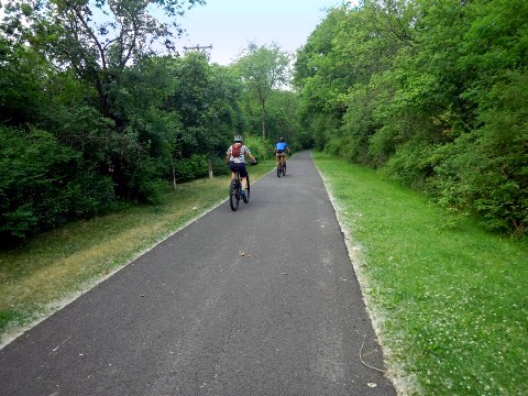
Hudson River Valley Greenway Trail - Manhattan to Albany - This report covers Greenway trails that are part of the Empire State Trail from Manhattan to Albany. Paved with just a few on-road sections.
Erie Canalway Trail
This section runs from Albany to Buffalo, about 350 miles. Follows the route of the Erie Canal, running on Canal towpath and along parallel rail routes. Urban, suburban and rural areas, with paved asphalt and unpaved stonedust portions, and some sections on the road.
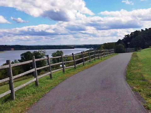
Erie Canalway Trail - Albany to Buffalo - We cover the Erie Canal Trail in four sections: East (Albany to Little Falls), East-Central (Little Falls to Syracuse), West-Central (Syracuse to Rochester), and West (Rochester to Buffalo).
Champlain Valley Trail
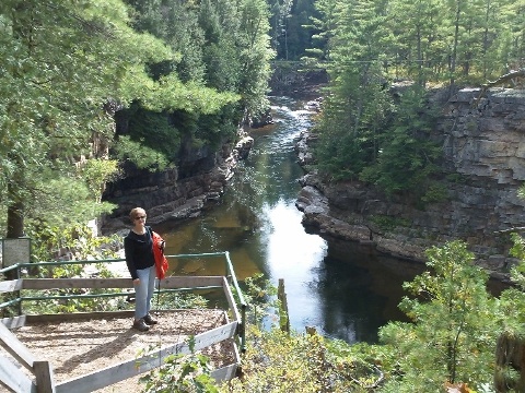
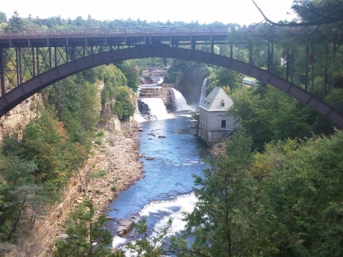
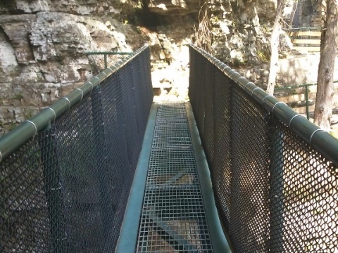
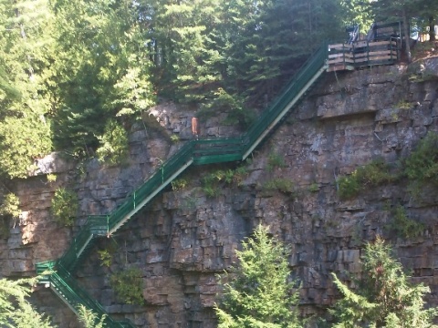
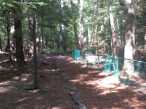
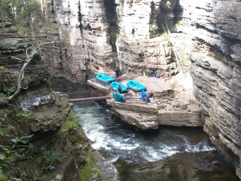
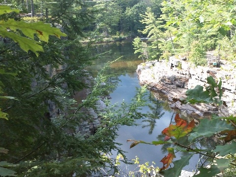
This section runs from Albany to the Canadian border at Rouses Point, about 190 miles. It follows the Champlain Canalway Trail from Albany to Whitehall, then past Whitehall is entirely on-road along State Bike Route 9. We haven't yet visited this area from a bicycling perspective, but did have a chance to visit and hike at Ausable Chasm, which lies along the Champlain Valley Trail at Lake Champlain near Keeseville, NY.
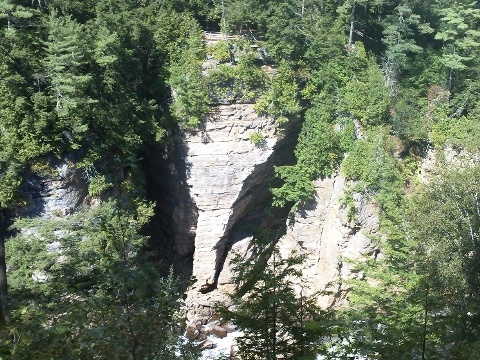
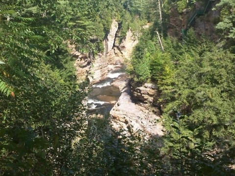
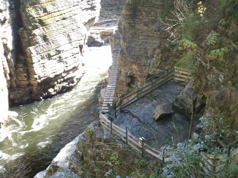
Ausable Chasm
"The Grand Canyon of the Adirondacks " is one of the oldest
natural attractions in the U.S. (1870). Absolutely stunning, with
scenic views, waterfalls, and bridges - worth the stop. The Ausable
River flows through the 2.2 mile sandstone canyon carved out over
more than 15,000 years. Activities include hiking, rock climbing,
and rafting. Visitor center with restrooms, gift shop, restaurant.
Nearby campground (tent and RV camping, cabins, mountain biking
trails, pool). Fee applies. Open year-round, guided hiking and float
tours are offered May-October:
More
information
Self-guided walking tours range from 1 mile to a total of 5:
- Inner Sanctum Trail (1 mile)
- Rim Walk Trail (2 miles)
- Dry Chasm Trail (1.5 miles)
- Rainbow Falls/Elephant's Head Vista (1/2 mile)


Bonus: For more biking, take the ferry at nearby Port Kent across Lake Champlain to Burlington, Vermont, and bike the Island Line Trail with its signature 2.5 mile causeway and bike ferry.
More Information and Resources
More Biking:
Bike-New York
- More information about biking in New York State
Related Resources:
New York State
- Empire State Trail
New York State - Bicycling the Empire State Trail
Support and Advocacy:
Parks &
Trails New York

Copyright © BikeTripper.net. All Rights Reserved. Have Bikes - Will Travel