Bike Tripper
Have Bikes, Will Travel
Bike Trail Maps & Photos Galore
You are here > Home >
New York >
Hudson Valley Rail-Trail
Reported: June 2022
Hudson Valley Rail Trail...
Biking from the Hudson River to New Paltz, NY
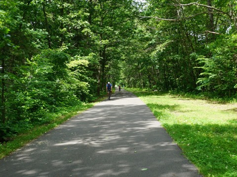
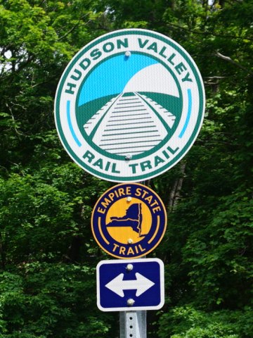
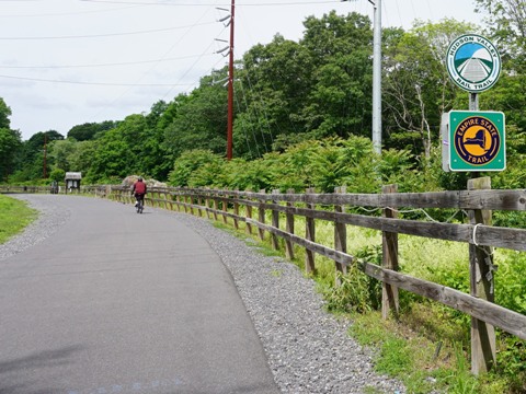
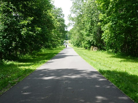
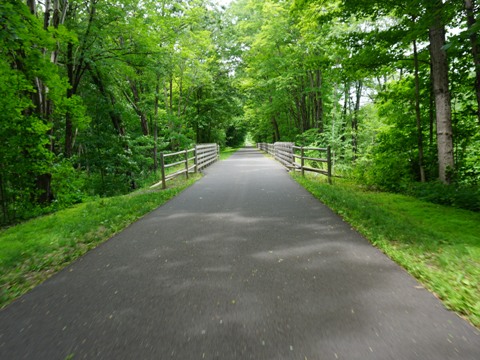
The Hudson Valley Rail Trail runs for 7 miles between Highland and New Paltz, NY, on an old New York, New Haven & Hartford Railroad railbed. Part of the Empire State Trail, it links to the Walkway Over the Hudson State Historic Park at the east and Wallkill Valley Rail Trail to the west (links below). The trail is wide and well-maintained, an easy ride. Historic markers, benches, and fitness stations are situated along the trail. Excellent signage helps keep bikers on track. (Detailed map and photos below.)
Location: Ulster County (Highland to New Paltz) (See map)
Distance: 7 miles, plus 1.5 mile on-road connector
to Wallkill Valley Rail Trail
Surface: Asphalt, 12 feet
Trailheads/Parking:
Ulster Visitor Center, Commercial Ave., Highland Rotary Pavilion, Tony Williams Park,
Rte. 299/South St.
Nearby Places of Interest: State
University of NY (SUNY) at New Paltz, Black Creek Preserve, Minnewaska State Park Preserve,
Mohonk Preserve, Mohonk Mountain House
Bike Shops/Rentals:
Hudson Bike Co.  (Highland;
rentals, sales, service)
(Highland;
rentals, sales, service)
Bicycle Depot (New
Paltz; rentals, sales, service)
The Bicycle Rack (New
Paltz; sales, service)
Page Summary:
- Biking the Hudson Valley Rail Trail
- Eastern Trailhead to Highland Rotary
Pavilion
- Eastern Trailhead to Highland Hamlet
- Highland Hamlet to Highland Rotary Pavilion - Highland Rotary Pavilion to Tony Williams Park
- Woods Walk old railbed, Black Creek access - Tony Williams Park to New Paltz
- Tony Williams Park to Rt. 299
- Rt. 299 to Paved Trail End
- Connector to Wallkill Valley Rail Trail
- Some History
- More Information and Resources
Biking the Hudson Valley Rail Trail... Comments and Photos
 We visited the trail from east to west.
Starting from the Poughkeepsie-Highland Bridge (Walkway Over the
Hudson), it's fully paved. The first 5 miles are shaded, running
through scenic woodlands and across Black Creek. The next two miles
run on a separate path along Rt. 299, then a 1.5 mile connector on
the road runs to the Wallkill Valley Rail Trail. Used by bikers,
walkers, hikers, and equestrians - bikers must yield to pedestrians,
both bikers and pedestrians must yield to horse riders.
We visited the trail from east to west.
Starting from the Poughkeepsie-Highland Bridge (Walkway Over the
Hudson), it's fully paved. The first 5 miles are shaded, running
through scenic woodlands and across Black Creek. The next two miles
run on a separate path along Rt. 299, then a 1.5 mile connector on
the road runs to the Wallkill Valley Rail Trail. Used by bikers,
walkers, hikers, and equestrians - bikers must yield to pedestrians,
both bikers and pedestrians must yield to horse riders.
Eastern Trailhead to Highland Rotary Pavilion - 2 miles
Eastern Trailhead to Highland Hamlet
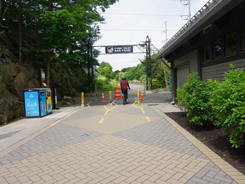
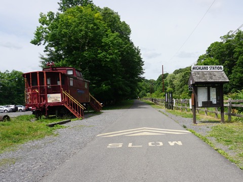
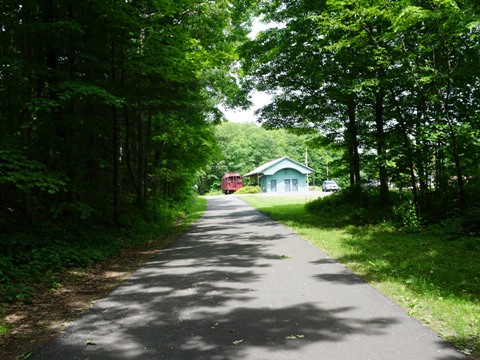
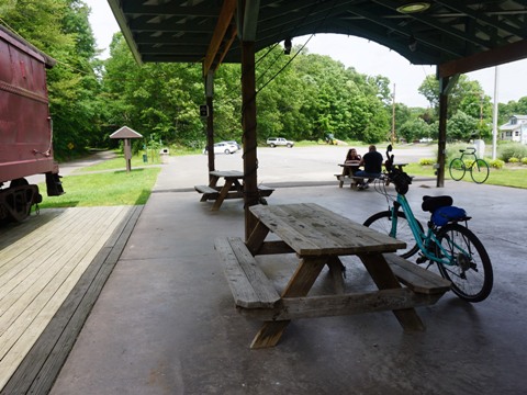
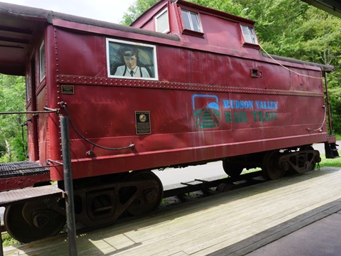
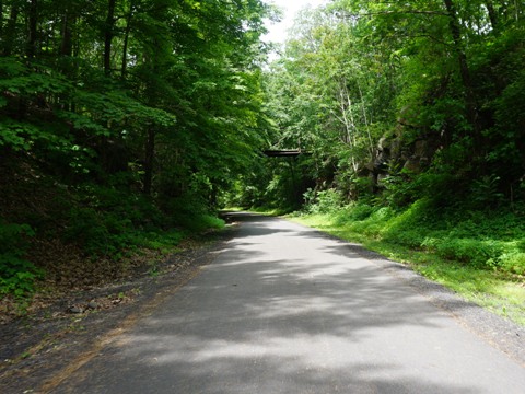
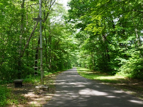
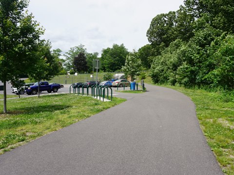
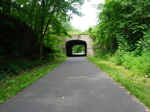
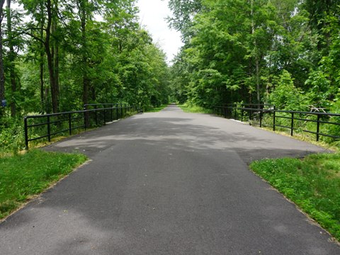
The trail starts from the Ulster Visitor Center at the Poughkeepsie-Highland Railroad Bridge, and is shared with the Walkway Over the Hudson State Historic Park (parking, restrooms, covered patio, concession stand, and bike rentals). Additional parking is available about 0.1 mile further west, behind the 1926 caboose exhibit. The trail enters a scenic section including several rock cuts, then two roads cross above on arched stone bridges (Mile Hill Rd. and US 9W). After crossing the bridge over Vineland Ave. (US 44), the trail enters a more populated section running past Highland Hamlet with restaurants and shops, accessible from Commercial Ave. - parking is available along the trail.
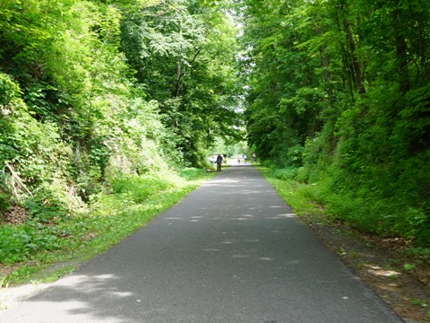
Highland Hamlet to Highland Rotary Pavilion
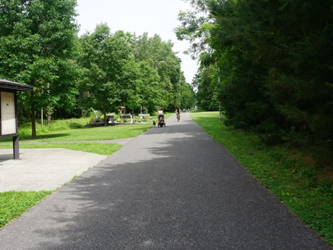
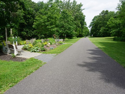
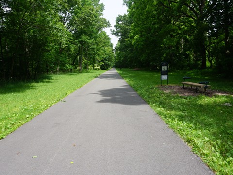
Past Commercial Ave. are the Highland Rotary Centennial Garden, and the Frank Maier Train Park (an Eagle Scout project honoring a grandfather's love of trains). A fitness course runs 1/2 mile past this area, then the trail continues through a wooded section paralleling but well-buffered from New Paltz Road, with one private dirt road crossing. The Highland Rotary Club provides ongoing support of the trail, and the Highland Rotary Pavilion (parking, restrooms, picnic) is one of several amenities built for trail users. The 1915 caboose, donated by a local businessman, was one of the first made of steel rather than wood
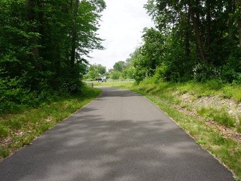
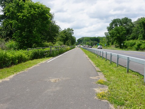
Highland Rotary Pavilion to Tony Williams Park - 1.5 miles
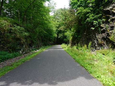
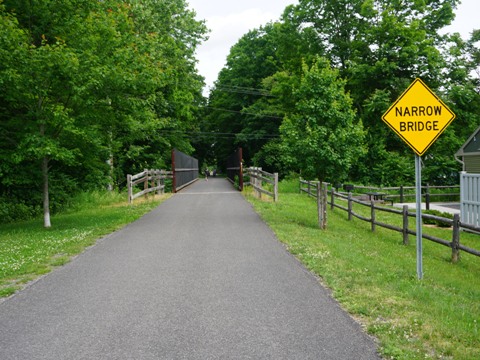
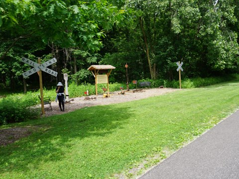
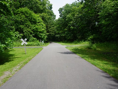
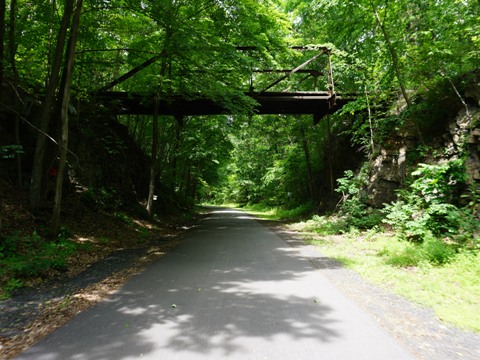
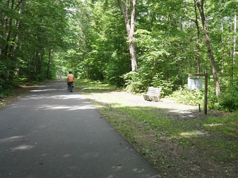
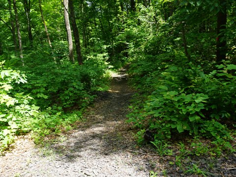
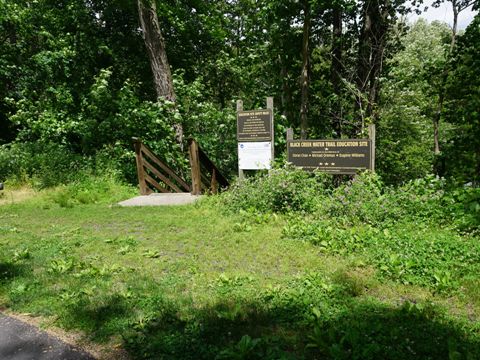
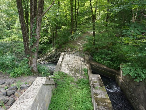
Past Highland Rotary Pavilion is another scenic section, wooded with numerous rock cuts. The old farmers bridge spanning the trail is a highlight, then New Paltz Road crosses the trail over a stone arch bridge. To the right off the trail is the Woods Walk, a trail to the original, lower-lying rail bed - there are two access points, one on a gravel path, the other down a stone stairway. This section is in the Black Creek wetlands, the trail crosses over Black Creek, and a wooden stairway leads down to the creek (fishing, paddlers may be seen). In another 4/10 mile, you arrive at Tony Williams Park.

Tony Williams Park to New Paltz - 3.5 miles
Tony Williams Park to Rt. 299
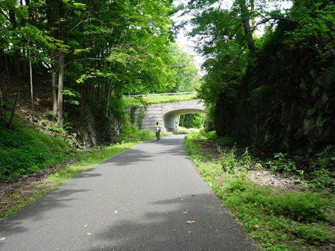
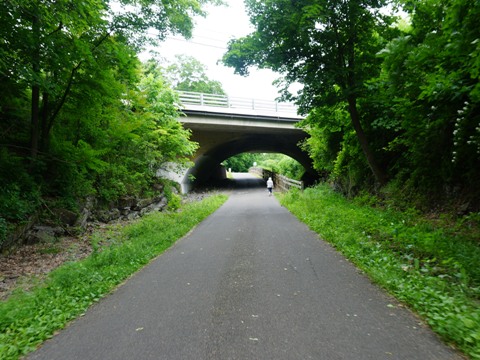
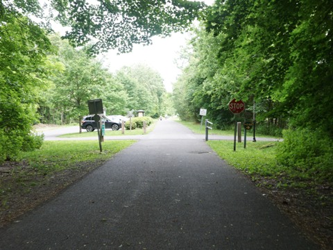
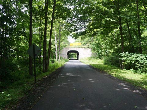
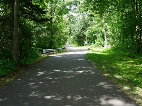
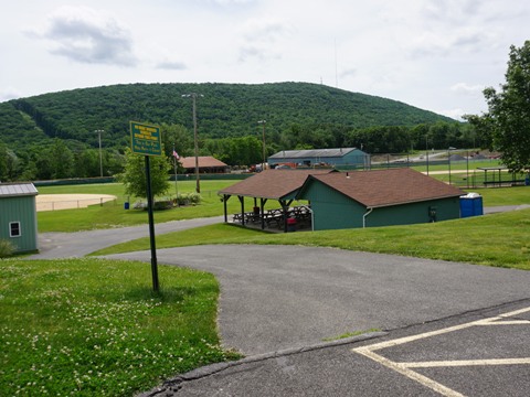
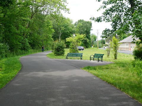
Tony Williams Park has parking, restrooms, picnic, playground, and playing fields. Some railroad bridge remnants remain. Just past the park, the trail runs under S. Riverside Rd., then shortly followed by an underpass at New Paltz Rd. Black Creek continues to meander throughout this section, with several trail crossings. The first is a unique "double bridge" that carries (1) the rail bed over the creek and (2) an old farm road under the rail bed but over the creek. The trail draws closer to New Paltz Rd., crosses Black Creek yet again, and then emerges onto Rt. 299.

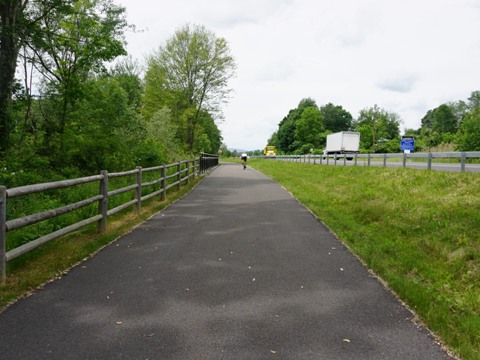
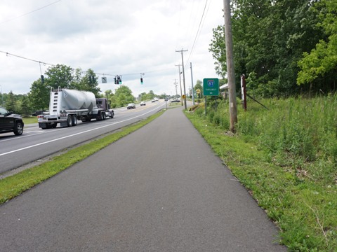
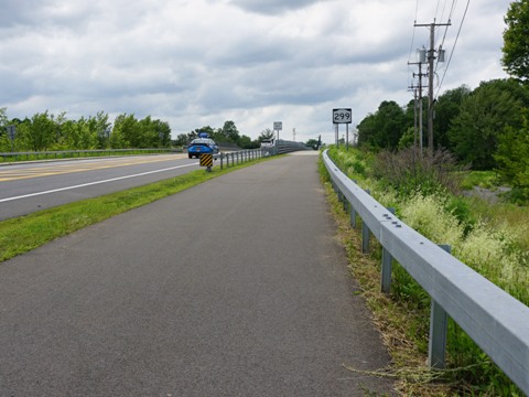
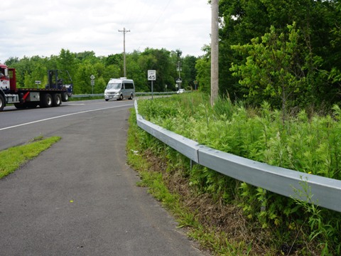
Rt. 299 to Off-road Trail End
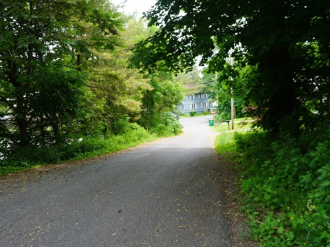
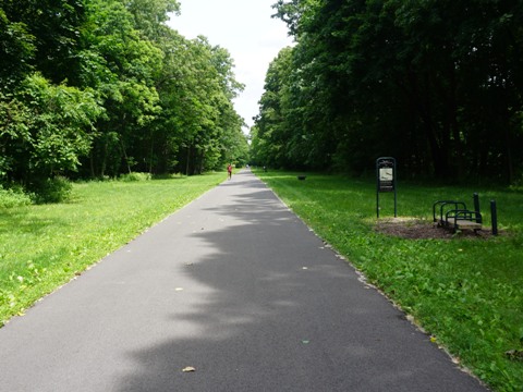
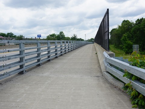
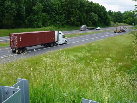
The two miles along Rt. 299 (Main St.) were completed as part of the Empire State Trail project (750 miles from Manhattan to Canada, and from Albany to Buffalo). There are some road crossings in this section, so take care. After emerging from the woods, the trail runs alongside Rt. 299 on the south side, with a trailhead located just east of South St. After crossing to the north side of the road, a trail bridge runs over the NY State Thruway (US 98), then the off-road trail ends at N. Putt Corners Rd.
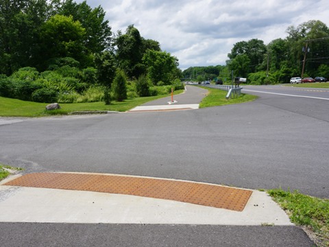
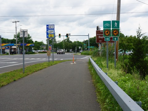
Connector to Wallkill Valley Rail Trail - 1.5 miles, on-road
At N. Putt Corners Rd., turn right and follow the on-road route (bike lanes). Cross at Henry W. DuBois Dr. (about 300 feet), continuing on buffered bike lanes for one mile to Chestnut St. Turn right on Chestnut, then left onto Mulberry St. to the Wallkill Valley Rail Trail.
Note: At N. Putt Corners, a pedestrian route continues straight alongside Main St. on sidewalks. The bike route is on the New Paltz Bypass, avoiding congestion and the many road and business crossings along Main St.
Some History
The trail was originally part of the Poughkeepsie Bridge Route leading to the bridge over the Hudson that today is Walkway Over the Hudson Historic State Park. The bridge, dating from 1889, was a major rail corridor between the Midwest and Northeast. Abandoned after a fire in 1974, it fell into private hands but continued to decline. The right of way west of the Hudson was eventually seized for non-payment of taxes in 1991. Then a broadband company seeking to lay fiberoptic cable paid for an easement through the corridor (that remains today). Those funds enabled development of the rail trail, and in 1997 the first 2.5 miles of the Hudson Valley Rail Trail opened. Subsequently, it's been extended to 7 miles.
More Information and Resources
Nearby Biking:
Walkway Over the Hudson State Historic Park
Wallkill Valley Rail Trail
Empire State Trail -
Manhattan to Albany, Canada, and Buffalo
Bike-New York
- More bike trails and information about biking in New York State
Related Resources:
Ulster County - Hudson Valley Rail Trail
Empire State Trail - Hudson Valley Rail Trail
Support and Advocacy:
Hudson Valley
Rail Trail Association

Copyright © BikeTripper.net. All Rights Reserved. Have Bikes - Will Travel